|
search place name
|
||
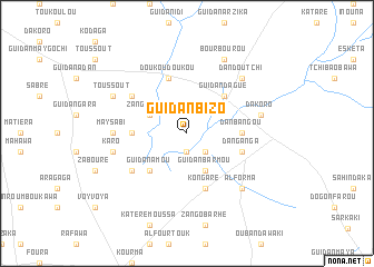
Guidan Bizo (Tahoua, Niger)Guidan Bizo is a town in the Tahoua region of Niger. An overview map of the region around Guidan Bizo is displayed below.
regional and 3d topo map of Guidan Bizo, Niger ::
Guidan Bizo airports ::
The nearest airport is MFG - Maradi, located 90.3 km east of Guidan Bizo.
Other airports nearby include SKO - Sokoto Sadiq Abubakar Iii Intl (157.7 km south west), THZ - Tahoua (166.9 km north west), QUS - Gusau (184.0 km south), Nearby towns ::
Guidan Konyao (1.9km south) //
Albawa (2.6km south east) //
Zango Malik (4.0km north west) //
Sahabi (4.0km north west) //
Guidan Barmou (4.1km south east) //
Guidan Dagué (5.2km north east) //
Guidan Amou (5.2km south west) //
Guidan Chibkao (5.4km west) //
Dan Bangou (5.4km east) //
Doukou Doukou (5.8km north) //
Kongaré (5.8km south) //
Dan Ganga (5.7km east) //
Bagarwa (6.5km north west) //
Dan Amaria (6.5km south west) //
May Sabi (7.2km west) //
Karo (7.4km west) //
Dakoro (7.4km east) //
Dan Doutchi (7.7km north east) //
Alforma (7.8km south east) //
Bourbourou (8.2km north east) //
Toussout (8.1km north west) //
[all distances 'as the bird flies' and approximate] 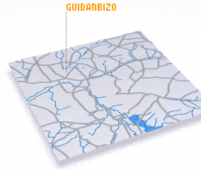 Places with similar names to Guidan Bizo, Niger ::
// Guidan Basso (NE)
// Guidan Bassou (NE)
// Guidan Bazé (NE)
// Guidan Bizo (NE)
// Guidan Bizo (NE)
// Guidan Bizo (NE)
// Guidan Bouzey (NE)
// Guidan Bouzou (NE)
// Guidan Bouzou (NE)
// Guidan Bouzou (NE)
Disclaimer :: Information on this page comes without warranty of any kind |
||
|
Where is Guidan Bizo? Elevation and coordinates ::
Latitude (lat): 13°48'0"N Longitude (lon): 6°21'0"E
Elevation (approx.): 312m (map arrows pan, magnifying glasses zoom) |
||
|
Visiting Guidan Bizo? Hotel/Accommodation ::
Book a hotel in Guidan Bizo Travel Guide ::
Buy a travel guide for Niger rental cars ::
car rental offers GPS waypoint ::
download a GPX waypoint (PoI) of Guidan Bizo for your GPS receiver
|
||