|
search place name
|
||
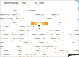
Guidan Sami (Maradi, Niger)Guidan Sami is a town in the Maradi region of Niger. An overview map of the region around Guidan Sami is displayed below.
regional and 3d topo map of Guidan Sami, Niger ::
Guidan Sami airports ::
The nearest airport is MFG - Maradi, located 124.1 km south of Guidan Sami.
Other airports nearby include ZND - Zinder (189.6 km south east), Nearby towns ::
Guidan Bouzou (1.8km east) //
Guidan Salao Saboa (3.7km south) //
Dan Ijo (3.6km west) //
Gadaré (4.0km south east) //
Guidan Éko (5.2km south west) //
Konkormawa (5.2km north east) //
Zangon Mahama (5.6km south) //
Maydoubou (5.6km north) //
Dan Ijo Kondilo (5.8km north) //
Guidan Mahama (5.7km west) //
Guidan Malam (6.6km south west) //
Labi (6.5km south east) //
Guidan Tanko (7.2km west) //
Guidan Mayara (7.4km west) //
Guidan Salao (7.6km south) //
Guidan Makao (7.4km east) //
Guidan Labo Baré (7.7km south west) //
Guidan Ali (8.2km south west) //
Guidan Mayadya (8.2km north west) //
Guidan Kané (9.2km south west) //
Guidan Bouzou (9.1km south east) //
Zangon Alhèr (9.1km south east) //
Dan Sarko (9.1km north east) //
Guidan Agada (10.3km north west) //
[all distances 'as the bird flies' and approximate] 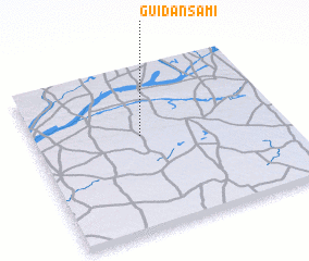 Places with similar names to Guidan Sami, Niger ::
// Guidan Sami (NE)
// Guidan Sami (NE)
// Guidan Sami (NE)
// Guidan Sami (NE)
// Guidan Sami (NE)
// Kot Nizām (PK)
// Kot Nizām (PK)
// Kutansami (NG)
Disclaimer :: Information on this page comes without warranty of any kind |
||
|
Where is Guidan Sami? Elevation and coordinates ::
Latitude (lat): 14°35'0"N Longitude (lon): 7°26'0"E
Elevation (approx.): 442m (map arrows pan, magnifying glasses zoom) |
||
|
Visiting Guidan Sami? Hotel/Accommodation ::
Book a hotel in Guidan Sami Travel Guide ::
Buy a travel guide for Niger rental cars ::
car rental offers GPS waypoint ::
download a GPX waypoint (PoI) of Guidan Sami for your GPS receiver
|
||