|
search place name
|
||
Guidan Zagui (Maradi, Niger)Guidan Zagui is a town in the Maradi region of Niger. An overview map of the region around Guidan Zagui is displayed below.
regional and 3d topo map of Guidan Zagui, Niger ::

Guidan Zagui airports ::
The nearest airport is MFG - Maradi, located 113.6 km south of Guidan Zagui.
Other airports nearby include ZND - Zinder (174.4 km south east), Nearby towns ::
Koda (3.4km north) //
Maywalkin Biri (3.5km north) //
Chadouka (4.2km south) //
Guidan Douké (4.2km south) //
Louga Nalèlo (4.2km north west) //
Daourawa (4.3km north east) //
Dan Tchinya (5.1km south east) //
May Tagaza (5.8km north west) //
Yérima (6.2km west) //
Dan Doukié (6.3km west) //
Guidan Dan Déla (6.4km east) //
Guidan Dogo (7.6km south east) //
Janbara (8.0km north west) //
Guidan Maydoubou (8.0km west) //
Guidan Aékao (8.3km south) //
Karawa (8.1km west) //
Guidan Kaboy (8.6km north west) //
Kandili (8.9km north) //
Toudoun Baki (8.8km east) //
Zangon Alhèr (9.2km north) //
Guidan Bouzou (9.2km north) //
Jéfhao (9.5km north east) //
Guidan Alambaji (10.0km south west) //
Guidan Salao (10.6km north west) //
Monataré (11.3km south east) //
[all distances 'as the bird flies' and approximate] 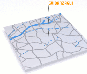 Places with similar names to Guidan Zagui, Niger ::
// Gdańsk (PL)
// Kaitiniškė (LT)
// Kadıncık (TR)
// Kodinsk (RU)
// Kudunskiy (RU)
// Koutinasogo (BF)
// Katansiga (GH)
// Guidan Aska (NE)
// Guidan Assoko (NE)
// Guidan Zaga (NE)
Disclaimer :: Information on this page comes without warranty of any kind |
||
|
Where is Guidan Zagui? Elevation and coordinates ::
Latitude (lat): 14°27'13"N Longitude (lon): 7°31'26"E
Elevation (approx.): 442m (map arrows pan, magnifying glasses zoom) |
||
|
Visiting Guidan Zagui? Hotel/Accommodation ::
Book a hotel in Guidan Zagui Travel Guide ::
Buy a travel guide for Niger rental cars ::
car rental offers GPS waypoint ::
download a GPX waypoint (PoI) of Guidan Zagui for your GPS receiver
|
||