|
search place name
|
||
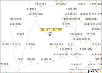
Guintchéré (Maradi, Niger)Guintchéré is a town in the Maradi region of Niger. An overview map of the region around Guintchéré is displayed below.
regional and 3d topo map of Guintchéré, Niger ::
Guintchéré airports ::
The nearest airport is MFG - Maradi, located 112.2 km south of Guintchéré.
Other airports nearby include THZ - Tahoua (205.1 km west), ZND - Zinder (215.8 km east), SKO - Sokoto Sadiq Abubakar Iii Intl (273.4 km south west), Nearby towns ::
Jigawa Boka (2.6km north west) //
Guidan Jigo (3.7km south) //
Zangon Mahama (4.1km south east) //
Tawarki (6.5km north east) //
Louga Aouta (7.7km north east) //
Guidan Sono (7.7km south east) //
Louga Iro (8.1km south west) //
Ardo Djédo (8.1km north east) //
Jariri (8.1km south east) //
Guidan Moussa (8.2km south east) //
Guidan Chaybou (8.9km south) //
Barka Kada (9.2km north east) //
Dogon Makochi (9.2km north west) //
Zangon Maïna Sara (9.1km north east) //
Zangon Abda (10.3km north east) //
[all distances 'as the bird flies' and approximate] 
Disclaimer :: Information on this page comes without warranty of any kind |
||
|
Where is Guintchéré? Elevation and coordinates ::
Latitude (lat): 14°31'0"N Longitude (lon): 7°8'0"E
Elevation (approx.): 417m (map arrows pan, magnifying glasses zoom) |
||
|
Visiting Guintchéré? Hotel/Accommodation ::
Book a hotel in Guintchéré Travel Guide ::
Buy a travel guide for Niger rental cars ::
car rental offers GPS waypoint ::
download a GPX waypoint (PoI) of Guintchéré for your GPS receiver
|
||