|
search place name
|
||
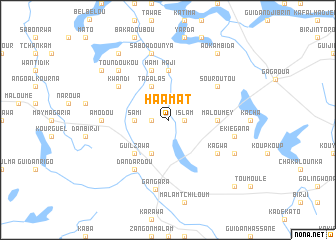
Haamat (Zinder, Niger)Haamat is a town in the Zinder region of Niger. An overview map of the region around Haamat is displayed below.
regional and 3d topo map of Haamat, Niger ::
Haamat airports ::
The nearest airport is ZND - Zinder, located 112.0 km south east of Haamat.
Other airports nearby include MFG - Maradi (199.0 km south west), Nearby towns ::
Islam (1.8km east) //
Kourami (1.8km west) //
Sami (3.6km west) //
Bourourou (4.1km south west) //
Biri (4.1km south west) //
Tagalas (4.1km north west) //
Guilzawa (5.2km south west) //
Haji (5.6km north) //
Maloumey (5.4km east) //
Hami (5.8km north) //
Kagwa (6.5km south east) //
Dan Dardou (6.6km south west) //
Kwandi (6.5km north west) //
Souroutou (6.5km north east) //
Amodou (7.2km west) //
Ekiégana (7.4km east) //
Guidan Halila (7.6km north) //
Saboa Dounya (7.6km north) //
Toundoukou (7.7km north west) //
Gangara (7.9km south) //
Foukiné (8.1km south east) //
Gouagourzo (9.1km north west) //
Aokambida (9.2km north east) //
Akourki (9.2km north west) //
Kabiwa (10.3km south east) //
[all distances 'as the bird flies' and approximate] 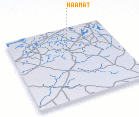 Places with similar names to Haamat, Niger ::
Disclaimer :: Information on this page comes without warranty of any kind |
||
|
Where is Haamat? Elevation and coordinates ::
Latitude (lat): 14°41'0"N Longitude (lon): 8°31'0"E
Elevation (approx.): 484m (map arrows pan, magnifying glasses zoom) |
||
|
Visiting Haamat? Hotel/Accommodation ::
Book a hotel in Haamat Travel Guide ::
Buy a travel guide for Niger rental cars ::
car rental offers GPS waypoint ::
download a GPX waypoint (PoI) of Haamat for your GPS receiver
|
||