|
search place name
|
||
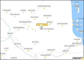
Kotawé (Niamey, Niger)Kotawé is a town in the Niamey region of Niger. An overview map of the region around Kotawé is displayed below.
regional and 3d topo map of Kotawé, Niger ::
Kotawé airports ::
The nearest airport is NIM - Niamey Diori Hamani, located 101.4 km south east of Kotawé.
Nearby towns ::
Kalfoussou (2.9km east) //
Bossa Bangou (3.1km west) //
Sandou (4.2km north east) //
Firinkin (4.3km west) //
Kolongal (5.8km north west) //
Kossaoua (6.0km north east) //
Bou Bangou (6.0km west) //
Zonkon (6.3km west) //
Bali Bali (6.8km south west) //
Boubou Bangou (7.7km west) //
Kolènsé (9.1km north west) //
Ouaïré (11.3km north west) //
[all distances 'as the bird flies' and approximate] 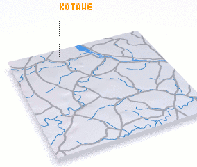 Places with similar names to Kotawé, Niger ::
Disclaimer :: Information on this page comes without warranty of any kind |
||
|
Where is Kotawé? Elevation and coordinates ::
Latitude (lat): 13°56'44"N Longitude (lon): 1°22'31"E
Elevation (approx.): 237m (map arrows pan, magnifying glasses zoom) |
||
|
Visiting Kotawé? Hotel/Accommodation ::
Book a hotel in Kotawé Travel Guide ::
Buy a travel guide for Niger rental cars ::
car rental offers GPS waypoint ::
download a GPX waypoint (PoI) of Kotawé for your GPS receiver
|
||