|
search place name
|
||
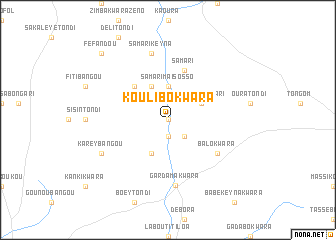
Koulibo Kwara (Niamey, Niger)Koulibo Kwara is a town in the Niamey region of Niger. An overview map of the region around Koulibo Kwara is displayed below.
regional and 3d topo map of Koulibo Kwara, Niger ::
Koulibo Kwara airports ::
The nearest airport is NIM - Niamey Diori Hamani, located 46.8 km south of Koulibo Kwara.
Nearby towns ::
Libo Atou Kwara (0.0km north) //
Loguébi (1.9km south) //
Sinnsan Kaoura (2.6km south east) //
Samari Maïsosso (3.7km north) //
Libo Gaoucholon (4.1km north west) //
Sinnsan Samari (4.0km north east) //
Kadié Dounkeye (4.1km south west) //
Banigorou (5.2km north west) //
Samari (5.8km north) //
Balo Kwara (6.5km south east) //
Gardama Kwara (7.3km south) //
Samari Keyna (7.6km north) //
Karey Bangou (8.1km south west) //
Fe Fandou (10.3km north west) //
[all distances 'as the bird flies' and approximate] 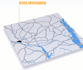 Places with similar names to Koulibo Kwara, Niger :: Disclaimer :: Information on this page comes without warranty of any kind |
||
|
Where is Koulibo Kwara? Elevation and coordinates ::
Latitude (lat): 13°54'0"N Longitude (lon): 2°15'0"E
Elevation (approx.): 217m (map arrows pan, magnifying glasses zoom) |
||
|
Visiting Koulibo Kwara? Hotel/Accommodation ::
Book a hotel in Koulibo Kwara Travel Guide ::
Buy a travel guide for Niger rental cars ::
car rental offers GPS waypoint ::
download a GPX waypoint (PoI) of Koulibo Kwara for your GPS receiver
|
||