|
search place name
|
||
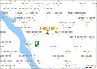
Takatama (Maradi, Niger)Takatama is a town in the Maradi region of Niger. An overview map of the region around Takatama is displayed below.
regional and 3d topo map of Takatama, Niger ::
Takatama airports ::
The nearest airport is MFG - Maradi, located 5.5 km south west of Takatama.
Other airports nearby include QUS - Gusau (159.1 km south), ZND - Zinder (198.5 km east), KAN - Kano Mallam Aminu Intl (220.8 km south east), SKO - Sokoto Sadiq Abubakar Iii Intl (223.1 km west), Nearby towns ::
Galadindi (1.8km east) //
Katéré Guidan Ousmane (1.8km west) //
Dan Gamji (2.6km north east) //
Tajaé (3.6km east) //
Soura Aboubakar (5.4km west) //
Dan Kari (5.8km south) //
Fadin Kay (6.6km north east) //
Guidan Bori (7.2km east) //
Darey (7.4km north) //
Gangara (7.4km east) //
Matayko (7.4km east) //
Dangara Saboa (7.8km north west) //
Rougawa (8.2km north east) //
Maradi (8.9km south west) //
Dangara (9.2km north west) //
Matada (9.1km north west) //
Dalya (10.3km south east) //
Konyagou (10.3km north east) //
[all distances 'as the bird flies' and approximate]  Places with similar names to Takatama, Niger ::
// Tokhtamay (RU)
// Dukedom (US)
// Takatami (BF)
// Dguidame (TD)
// Doko Tombo (NE)
// Taka Tiémé (NE)
// Dagdam (SN)
// Tigdiam (SN)
// Tak Dām (IR)
// Tak Dām (IR)
Disclaimer :: Information on this page comes without warranty of any kind |
||
|
Where is Takatama? Elevation and coordinates ::
Latitude (lat): 13°32'0"N Longitude (lon): 7°10'0"E
Elevation (approx.): 357m (map arrows pan, magnifying glasses zoom) |
||
|
Visiting Takatama? Hotel/Accommodation ::
Book a hotel in Takatama Travel Guide ::
Buy a travel guide for Niger rental cars ::
car rental offers GPS waypoint ::
download a GPX waypoint (PoI) of Takatama for your GPS receiver
|
||