|
search place name
|
||
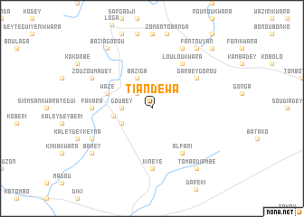
Tiandewa (Dosso, Niger)Tiandewa is a town in the Dosso region of Niger. An overview map of the region around Tiandewa is displayed below.
regional and 3d topo map of Tiandewa, Niger ::
Tiandewa airports ::
The nearest airport is NIM - Niamey Diori Hamani, located 111.9 km west of Tiandewa.
Other airports nearby include SKO - Sokoto Sadiq Abubakar Iii Intl (225.7 km east), Nearby towns ::
Bani Dey (2.6km north west) //
Goubey (3.6km west) //
Baziga (4.1km north west) //
Dourougouna (4.1km south west) //
Sokorbey (4.8km west) //
Wazé (5.7km west) //
Garbey Gorou (6.6km north east) //
Haouèyefandou (6.6km north east) //
Alfari (6.6km south east) //
Loulou Kwara (6.6km north east) //
Fakara (7.2km west) //
Kineye (7.4km south) //
Dambazi (8.2km north east) //
Zouzoumadey (8.1km north west) //
Diaouga Midou Dey (8.1km south west) //
Fantouyan (9.2km north east) //
Baziagorou (9.2km north west) //
Tombo Diambé (9.2km south east) //
Bamey (9.1km south west) //
Badara Dey (10.3km north east) //
[all distances 'as the bird flies' and approximate] 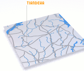 Places with similar names to Tiandewa, Niger ::
// Shuntwi (MM)
// Chandwa (IN)
// Chandwa (ZM)
// Shindiwi (NG)
// Chintiwi (MZ)
// Ch'uan-ti-wo (TW)
// Chün-t'ou-wei (TW)
// Chondwe (ZM)
// Shandawei (CN)
// Tiantouwei (CN)
Disclaimer :: Information on this page comes without warranty of any kind |
||
|
Where is Tiandewa? Elevation and coordinates ::
Latitude (lat): 13°31'0"N Longitude (lon): 3°13'0"E
Elevation (approx.): 241m (map arrows pan, magnifying glasses zoom) |
||
|
Visiting Tiandewa? Hotel/Accommodation ::
Book a hotel in Tiandewa Travel Guide ::
Buy a travel guide for Niger rental cars ::
car rental offers GPS waypoint ::
download a GPX waypoint (PoI) of Tiandewa for your GPS receiver
|
||