|
search place name
|
||
Zangon Kané (Maradi, Niger)Zangon Kané is a town in the Maradi region of Niger. An overview map of the region around Zangon Kané is displayed below.
regional and 3d topo map of Zangon Kané, Niger ::

Zangon Kané airports ::
The nearest airport is MFG - Maradi, located 77.3 km south west of Zangon Kané.
Other airports nearby include ZND - Zinder (172.1 km east), QUS - Gusau (231.3 km south), Nearby towns ::
Zangon Kanta (1.9km south) //
May Bagay (1.9km north) //
Kwarou (1.8km east) //
Zangon Yia (3.6km west) //
Guidan Koré (3.7km south) //
Dan Yia (4.0km south east) //
Toukounda (5.2km south west) //
Guidan Doutchi (5.2km north west) //
Dan Kisko (5.4km west) //
Guidan Aman (5.4km west) //
Tossa (5.4km east) //
Kataré (5.8km north) //
Wada (5.8km south) //
Dan Kandé (6.5km south east) //
Mayguizaza (6.6km south west) //
Sèrkian Atchi (7.4km south) //
Dan Tchili (7.4km north) //
Guidan Abarchi (7.4km west) //
Guidan Agali (7.6km north) //
Gardi (7.6km north) //
Dan Zabo (7.7km north west) //
Djali (8.2km south west) //
Baraya (8.1km south west) //
Kourou Kourou (8.1km north west) //
Maykoulaha (8.1km north east) //
Ardo Aléké (8.1km north east) //
Fadama (9.2km south east) //
Guidan Bogwari (9.2km south east) //
Badakay (9.1km south west) //
[all distances 'as the bird flies' and approximate] 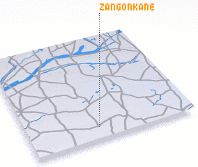 Places with similar names to Zangon Kané, Niger ::
// Sanggong-ni (KP)
// Sanggong-ni (KP)
// Sŏnggong-ni (KP)
// Songgong-ni (KP)
// Songgong-ni (KP)
// Sanggong-ni (KR)
// Sanggong-ni (KR)
// Sanggung-ni (KR)
// Sangong-ni (KR)
// Sin'gong-ni (KR)
Disclaimer :: Information on this page comes without warranty of any kind |
||
|
Where is Zangon Kané? Elevation and coordinates ::
Latitude (lat): 14°8'0"N Longitude (lon): 7°26'0"E
Elevation (approx.): 416m (map arrows pan, magnifying glasses zoom) |
||
|
Visiting Zangon Kané? Hotel/Accommodation ::
Book a hotel in Zangon Kané Travel Guide ::
Buy a travel guide for Niger rental cars ::
car rental offers GPS waypoint ::
download a GPX waypoint (PoI) of Zangon Kané for your GPS receiver
|
||