|
search place name
|
||
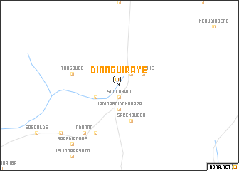
Dinnguiraye (Kolda, Senegal)Dinnguiraye is a town in the Kolda region of Senegal. An overview map of the region around Dinnguiraye is displayed below.
regional and 3d topo map of Dinnguiraye, Senegal ::
Dinnguiraye airports ::
The nearest airport is KLC - Kaolack, located 153.5 km north west of Dinnguiraye.
Other airports nearby include TUD - Tambacounda (154.4 km east), ZIG - Ziguinchor (159.6 km south west), BXO - Bissau Oswaldo Vieira Intl (165.0 km south west), BJL - Banjul Intl (181.2 km west), Nearby towns ::
Soulabali (1.9km south) //
Katonfara (2.6km north east) //
Madina Boïdo Kamara (3.7km south) //
Madianké (4.1km north east) //
Dinguiraye (4.1km south west) //
Saré Moudou (5.8km south) //
Tougoudé (7.5km west) //
Balkamissa (8.2km south west) //
Ndorna (9.2km south west) //
[all distances 'as the bird flies' and approximate]  Places with similar names to Dinnguiraye, Senegal ::
// Donkaraouye (BJ)
// Dinguiraye (SN)
// Dinguiraye (SN)
// Dinguiraye (SN)
// Dinguiraye (SN)
// Dinnguiraye (SN)
// Dinnguiraye (SN)
// Dinguiraye (GN)
// Toynokur'ye (RU)
// Dan Gorayo (SO)
Disclaimer :: Information on this page comes without warranty of any kind |
||
|
Where is Dinnguiraye? Elevation and coordinates ::
Latitude (lat): 13°14'0"N Longitude (lon): 14°59'0"W
Elevation (approx.): 40m (map arrows pan, magnifying glasses zoom) |
||
|
Visiting Dinnguiraye? Hotel/Accommodation ::
Book a hotel in Dinnguiraye Travel Guide ::
Buy a travel guide for Senegal rental cars ::
car rental offers GPS waypoint ::
download a GPX waypoint (PoI) of Dinnguiraye for your GPS receiver
|
||