|
search place name
|
||
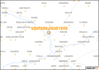
Doundodji Guèyène (Louga, Senegal)Doundodji Guèyène is a town in the Louga region of Senegal. An overview map of the region around Doundodji Guèyène is displayed below.
regional and 3d topo map of Doundodji Guèyène, Senegal ::
Doundodji Guèyène airports ::
The nearest airport is XLS - St. Louis Saint Louis, located 150.8 km north west of Doundodji Guèyène.
Other airports nearby include KLC - Kaolack (174.9 km south west), KED - Kaedi (194.5 km north east), TUD - Tambacounda (254.0 km south east), Nearby towns ::
Doundodji Tiako (1.8km west) //
Doundodji Nianguène (2.6km south east) //
Doundodji (2.6km south west) //
Tiékogne (3.7km north) //
Djambal (5.1km south west) //
Nioukou (5.4km east) //
Ndiakhaté (5.7km west) //
Somdadé (6.5km south east) //
Ngayène (6.6km south east) //
Balel Sissé (6.6km south east) //
Balel Sala (7.7km south east) //
Ndia Bondiel (7.7km south east) //
Ndiané (7.7km north west) //
Guidch (8.2km south east) //
Das Ngrou (8.0km north east) //
Dek Lès (10.3km north east) //
Tiébé (10.3km south west) //
[all distances 'as the bird flies' and approximate] 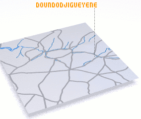 Places with similar names to Doundodji Guèyène, Senegal :: Disclaimer :: Information on this page comes without warranty of any kind |
||
|
Where is Doundodji Guèyène? Elevation and coordinates ::
Latitude (lat): 15°29'0"N Longitude (lon): 15°11'0"W
Elevation (approx.): 9m (map arrows pan, magnifying glasses zoom) |
||
|
Visiting Doundodji Guèyène? Hotel/Accommodation ::
Book a hotel in Doundodji Guèyène Travel Guide ::
Buy a travel guide for Senegal rental cars ::
car rental offers GPS waypoint ::
download a GPX waypoint (PoI) of Doundodji Guèyène for your GPS receiver
|
||