|
search place name
|
||
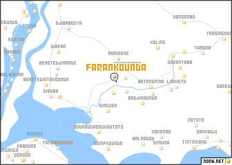
Farankounda (Kolda, Senegal)Farankounda is a town in the Kolda region of Senegal. An overview map of the region around Farankounda is displayed below.
regional and 3d topo map of Farankounda, Senegal ::
Farankounda airports ::
The nearest airport is ZIG - Ziguinchor, located 45.1 km south west of Farankounda.
Other airports nearby include BXO - Bissau Oswaldo Vieira Intl (94.4 km south), CSK - Cap Skiring (98.0 km west), BJL - Banjul Intl (107.0 km north west), KLC - Kaolack (159.5 km north), Nearby towns ::
Diaourou (1.6km north east) //
Dianioundi (1.8km south) //
Soukoutoto (2.2km south east) //
Yayakounda (2.9km north east) //
Niassène (3.9km north) //
Singuèr (4.8km south) //
Badjikounda (5.4km south east) //
Batan Gnima (5.6km east) //
Madina (6.1km east) //
Sibikouroto (6.4km south west) //
Boumouda Soukoutoto (8.6km south) //
Koling (8.6km north east) //
Subikouroto (8.7km east) //
Kokonba (11.4km south east) //
Djibabouya (11.5km north west) //
[all distances 'as the bird flies' and approximate] 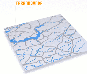 Places with similar names to Farankounda, Senegal ::
// Farankounda (SN)
// Farankounda (SN)
// Farankounda (SN)
// Varnā Kand (IR)
// Farancunda (GW)
// Farancunda (GW)
// Farancunda (GW)
// Farancunda (GW)
Disclaimer :: Information on this page comes without warranty of any kind |
||
|
Where is Farankounda? Elevation and coordinates ::
Latitude (lat): 12°42'47"N Longitude (lon): 15°53'56"W
Elevation (approx.): 13m (map arrows pan, magnifying glasses zoom) |
||
|
Visiting Farankounda? Hotel/Accommodation ::
Book a hotel in Farankounda Travel Guide ::
Buy a travel guide for Senegal rental cars ::
car rental offers GPS waypoint ::
download a GPX waypoint (PoI) of Farankounda for your GPS receiver
|
||