|
search place name
|
||
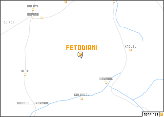
Féto Diami (Saint-Louis, Senegal)Féto Diami is a town in the Saint-Louis region of Senegal. An overview map of the region around Féto Diami is displayed below.
regional and 3d topo map of Féto Diami, Senegal ::
Féto Diami airports ::
The nearest airport is KED - Kaedi, located 109.6 km north east of Féto Diami.
Other airports nearby include TUD - Tambacounda (210.6 km south), BXE - Bakel (211.0 km east), KLC - Kaolack (243.0 km south west), Nearby towns ::
Bélel Boukar (2.6km north east) //
Kourbol (7.7km south east) //
[all distances 'as the bird flies' and approximate] 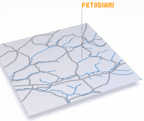 Places with similar names to Féto Diami, Senegal ::
// Phát Diệm (VN)
Disclaimer :: Information on this page comes without warranty of any kind |
||
|
Where is Féto Diami? Elevation and coordinates ::
Latitude (lat): 15°32'0"N Longitude (lon): 14°18'0"W
Elevation (approx.): 52m (map arrows pan, magnifying glasses zoom) |
||
|
Visiting Féto Diami? Hotel/Accommodation ::
Book a hotel in Féto Diami Travel Guide ::
Buy a travel guide for Senegal rental cars ::
car rental offers GPS waypoint ::
download a GPX waypoint (PoI) of Féto Diami for your GPS receiver
|
||