|
search place name
|
||
Gati-Tèf (Saint-Louis, Senegal)Gati-Tèf is a town in the Saint-Louis region of Senegal. An overview map of the region around Gati-Tèf is displayed below.
regional and 3d topo map of Gati-Tèf, Senegal ::

Gati-Tèf airports ::
The nearest airport is XLS - St. Louis Saint Louis, located 21.0 km west of Gati-Tèf.
Other airports nearby include DKR - Dakar Leopold Sedar Senghor Intl (191.4 km south west), KLC - Kaolack (206.9 km south), Nearby towns ::
Ndiobène Takhmbeut (1.3km north west) //
Keur Amadou Ndiaye (1.8km west) //
Takhmbeut Ouolof (2.5km north) //
Takhmbeut Peul (3.0km north) //
Mboulouk (3.4km south east) //
Boïti (3.5km north west) //
Ndioub Nâne Ouolof (3.8km south west) //
Yade Peul (4.6km south west) //
Yassagne (4.8km south east) //
Sintiou Thirmoye (5.1km south west) //
Ndioub Nâne Peul (5.3km south west) //
Yade Keur Abou Ba (5.6km south) //
Yade Ouolof (5.7km south west) //
Léona (6.2km north) //
Diassap (6.2km south west) //
Gonio (6.2km east) //
Keur Modou Ndiaye (6.4km south west) //
Yokoulène (6.4km east) //
Mboye (6.6km south west) //
Birane Gaye (7.3km south) //
Selguir (7.4km north west) //
Ndakhar (7.3km south east) //
Tèf (7.3km north west) //
Massar (7.7km south west) //
Keur Saidou Sow (7.7km west) //
Menguègne Peul (8.0km west) //
Tal Baklé (8.1km east) //
Gobak (8.5km north) //
Tal Diop (8.5km south east) //
[all distances 'as the bird flies' and approximate] 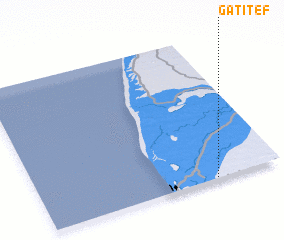 Places with similar names to Gati-Tèf, Senegal ::
Disclaimer :: Information on this page comes without warranty of any kind |
||
|
Where is Gati-Tèf? Elevation and coordinates ::
Latitude (lat): 16°0'14"N Longitude (lon): 16°16'23"W
Elevation (approx.): 7m (map arrows pan, magnifying glasses zoom) |
||
|
Visiting Gati-Tèf? Hotel/Accommodation ::
Book a hotel in Gati-Tèf Travel Guide ::
Buy a travel guide for Senegal rental cars ::
car rental offers GPS waypoint ::
download a GPX waypoint (PoI) of Gati-Tèf for your GPS receiver
|
||