|
search place name
|
||
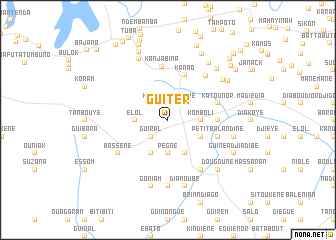
Guiter (Ziguinchor, Senegal)Guiter is a town in the Ziguinchor region of Senegal. An overview map of the region around Guiter is displayed below.
regional and 3d topo map of Guiter, Senegal ::
Guiter airports ::
The nearest airport is BJL - Banjul Intl, located 43.8 km north west of Guiter.
Other airports nearby include ZIG - Ziguinchor (62.2 km south), CSK - Cap Skiring (91.0 km south west), KLC - Kaolack (117.5 km north), BXO - Bissau Oswaldo Vieira Intl (153.2 km south east), Nearby towns ::
Kona (2.6km north west) //
Niaéré (2.6km north east) //
Guiral (2.6km south west) //
Elol (3.6km west) //
Pégné (3.7km south) //
Komboli (3.6km east) //
Boulouaye (4.1km south west) //
Néma (4.1km south east) //
Diakoye (4.1km south east) //
Kanao (5.3km north) //
Diakine (5.4km east) //
Katounor (5.7km east) //
Bounièye (5.7km east) //
Petit Balandine (5.7km east) //
Kanjabina (6.0km north) //
Kabounkout (6.4km north east) //
Djibiem (6.6km south east) //
Bassène (6.6km south west) //
Diongol (7.4km south) //
Kaur (7.5km north west) //
Guinéa (7.5km north east) //
Goniam (7.6km south) //
Dianoubé (7.6km south) //
Djiguirone (7.5km east) //
Bassen (7.8km north east) //
Dougouné (7.8km south east) //
Djibidione (7.8km south east) //
Jana Kuyel (7.8km north east) //
Djilakounda (7.9km north east) //
[all distances 'as the bird flies' and approximate] 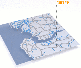 Places with similar names to Guiter, Senegal ::
Disclaimer :: Information on this page comes without warranty of any kind |
||
|
Where is Guiter? Elevation and coordinates ::
Latitude (lat): 13°7'0"N Longitude (lon): 16°19'0"W
Elevation (approx.): 34m (map arrows pan, magnifying glasses zoom) |
||
|
Visiting Guiter? Hotel/Accommodation ::
Book a hotel in Guiter Travel Guide ::
Buy a travel guide for Senegal rental cars ::
car rental offers GPS waypoint ::
download a GPX waypoint (PoI) of Guiter for your GPS receiver
|
||