|
search place name
|
||
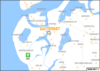
Guitonhat (Ziguinchor, Senegal)Guitonhat is a town in the Ziguinchor region of Senegal. An overview map of the region around Guitonhat is displayed below.
regional and 3d topo map of Guitonhat, Senegal ::
Guitonhat airports ::
The nearest airport is CSK - Cap Skiring, located 10.9 km south west of Guitonhat.
Other airports nearby include ZIG - Ziguinchor (43.3 km east), BJL - Banjul Intl (95.3 km north), BXO - Bissau Oswaldo Vieira Intl (128.2 km south east), KLC - Kaolack (196.6 km north), Nearby towns ::
Kaboukout (1.5km north west) //
Ourong (1.6km south) //
Tamani (2.1km north east) //
Sifoka (2.2km north west) //
Vindaye (2.4km west) //
Ihimba (3.2km south) //
Elinkinde (3.3km north) //
Ehidj (3.3km south west) //
Diakène Ouolof (4.2km south east) //
Yembakana (5.0km south) //
Diatem (5.2km east) //
Efrane Elinkine (5.4km north west) //
Kachiouane (5.5km north west) //
Santiaba Ouolof (5.9km north east) //
Diakène (6.0km south east) //
Efrane Kachiouane (6.6km north west) //
Samatit (7.3km north east) //
Essaoul (8.6km south east) //
Loudia Ouolof (8.5km north east) //
Guilafaguène (8.7km north west) //
Bouyouye (9.1km south west) //
Karabane (9.4km north) //
Kagnout (9.4km north east) //
Loudia Diola (9.8km north east) //
Kafar (10.0km north west) //
Boukot Ouolof (10.8km south west) //
Mlomp (12.0km north east) //
[all distances 'as the bird flies' and approximate] 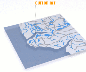 Places with similar names to Guitonhat, Senegal ::
// Kottenheide (DE)
Disclaimer :: Information on this page comes without warranty of any kind |
||
|
Where is Guitonhat? Elevation and coordinates ::
Latitude (lat): 12°28'36"N Longitude (lon): 16°40'20"W
Elevation (approx.): 1m (map arrows pan, magnifying glasses zoom) |
||
|
Visiting Guitonhat? Hotel/Accommodation ::
Book a hotel in Guitonhat Travel Guide ::
Buy a travel guide for Senegal rental cars ::
car rental offers GPS waypoint ::
download a GPX waypoint (PoI) of Guitonhat for your GPS receiver
|
||