|
search place name
|
||
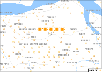
Kamarakounda (Ziguinchor, Senegal)Kamarakounda is a town in the Ziguinchor region of Senegal. An overview map of the region around Kamarakounda is displayed below.
regional and 3d topo map of Kamarakounda, Senegal ::
Kamarakounda airports ::
The nearest airport is ZIG - Ziguinchor, located 23.0 km west of Kamarakounda.
Other airports nearby include CSK - Cap Skiring (73.5 km west), BXO - Bissau Oswaldo Vieira Intl (81.6 km south east), BJL - Banjul Intl (111.4 km north west), KLC - Kaolack (181.8 km north), Nearby towns ::
Dianoundio (0.6km north west) //
Tourékounda (1.7km north east) //
Boutoupa (2.0km south west) //
Maoua (2.2km north) //
Samik Diola (3.6km east) //
Bourouhou (3.8km north) //
Yabone (4.0km north east) //
Samik Mandjak (4.1km south east) //
Barraca Fronteira (4.2km south) //
Barraca Banana (4.2km south) //
Barraca Poilão (4.3km south) //
Madina (4.5km east) //
Jambacosse (4.7km south) //
Diabane (4.8km north) //
Lati (4.9km east) //
Koumperto (5.0km north) //
Poubasse (5.0km south west) //
Trankile (5.9km north) //
Barraca Mampatás (6.1km south) //
Campanhe Bleque (6.0km south west) //
Bofa (6.4km west) //
Barraca Sancho (6.7km south east) //
Pouboul (6.8km west) //
Nema (7.1km south) //
Barraca Cana (7.3km south) //
Bagondante (7.4km south west) //
Bouranol Bessoloum (7.7km south east) //
Branol (7.7km south east) //
Canchungo (7.9km south) //
[all distances 'as the bird flies' and approximate] 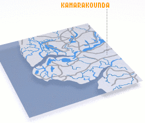 Places with similar names to Kamarakounda, Senegal ::
// Kāmārgānti (BD)
// Kāmārkānda (BD)
// Kāmārkāndi (BD)
// Komar Kāndi (BD)
// Kumāriākāndi (BD)
// Gomarakanda (LK)
// Kumburekanda (LK)
// Qamar Kandī (IR)
// Camaracunda (GW)
// Camaracunda (GW)
Disclaimer :: Information on this page comes without warranty of any kind |
||
|
Where is Kamarakounda? Elevation and coordinates ::
Latitude (lat): 12°30'15"N Longitude (lon): 16°4'36"W
Elevation (approx.): 27m (map arrows pan, magnifying glasses zoom) |
||
|
Visiting Kamarakounda? Hotel/Accommodation ::
Book a hotel in Kamarakounda Travel Guide ::
Buy a travel guide for Senegal rental cars ::
car rental offers GPS waypoint ::
download a GPX waypoint (PoI) of Kamarakounda for your GPS receiver
|
||