|
search place name
|
||
Keur Diankole (Kaolack, Senegal)Keur Diankole is a town in the Kaolack region of Senegal. An overview map of the region around Keur Diankole is displayed below.
regional and 3d topo map of Keur Diankole, Senegal ::

Keur Diankole airports ::
The nearest airport is KLC - Kaolack, located 129.5 km west of Keur Diankole.
Other airports nearby include TUD - Tambacounda (134.0 km east), BJL - Banjul Intl (200.7 km west), ZIG - Ziguinchor (211.1 km south west), BXO - Bissau Oswaldo Vieira Intl (235.3 km south), Nearby towns ::
Keur Sako Ndiaye (0.0km north) //
Diapto (1.9km south) //
Médina Sali (1.8km west) //
Sintiou Sali (1.8km west) //
Messéré Tiakel (2.6km south east) //
Touba Mbayène (2.6km north east) //
Keur Samba Dioubane (2.6km north west) //
Iliassa (3.7km south) //
Keur Goli (3.6km west) //
Mbouré (4.1km south west) //
Sali (4.0km south west) //
Keur Dadi Mboul (4.0km south west) //
Koumbidia (4.1km north east) //
Koho Sossé (5.2km south east) //
Keur Albé (5.2km north east) //
Keur Siné Mangane (5.2km north east) //
Kerma Fass (5.8km north) //
Taga Kati (5.7km west) //
Kotiar (6.5km north west) //
Kati (7.4km west) //
Pakala (7.7km south west) //
Saré Niama (7.7km north east) //
Koho Peul (8.1km south east) //
Vilanène (8.1km south west) //
Médina (9.1km north east) //
Ndanga (9.2km south east) //
Konga (9.1km north west) //
Kirim Brahim Mbaye (10.3km north west) //
Keur Bodié (10.3km north west) //
[all distances 'as the bird flies' and approximate] 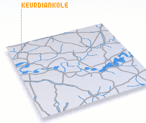 Places with similar names to Keur Diankole, Senegal ::
// Kretingalė (LT)
// Ćordina Kula (BA)
// Gardan Kolah (IR)
// Gardanai Kili (PK)
// Garden Gully (AU)
// Kerttuankylä (FI)
// Kortteenkylä (FI)
// Gorteenkeel (IE)
// Gortnakilly (IE)
Disclaimer :: Information on this page comes without warranty of any kind |
||
|
Where is Keur Diankole? Elevation and coordinates ::
Latitude (lat): 13°53'0"N Longitude (lon): 14°53'0"W
Elevation (approx.): 14m (map arrows pan, magnifying glasses zoom) |
||
|
Visiting Keur Diankole? Hotel/Accommodation ::
Book a hotel in Keur Diankole Travel Guide ::
Buy a travel guide for Senegal rental cars ::
car rental offers GPS waypoint ::
download a GPX waypoint (PoI) of Keur Diankole for your GPS receiver
|
||