|
search place name
|
||
Keur Modou Sèye (Louga, Senegal)Keur Modou Sèye is a town in the Louga region of Senegal. An overview map of the region around Keur Modou Sèye is displayed below.
regional and 3d topo map of Keur Modou Sèye, Senegal ::

Keur Modou Sèye airports ::
The nearest airport is XLS - St. Louis Saint Louis, located 92.4 km north of Keur Modou Sèye.
Other airports nearby include KLC - Kaolack (124.5 km south), DKR - Dakar Leopold Sedar Senghor Intl (153.8 km west), BJL - Banjul Intl (219.7 km south), Nearby towns ::
Kalsane (1.8km east) //
Keur Nasseurdè (2.6km north west) //
Sagata (2.6km north west) //
Kassé Dimmbo (2.6km south west) //
Tienne Sagata (2.6km south east) //
Derr (3.6km west) //
Keur Diaouli (3.7km north) //
Dara Yeral (4.0km north west) //
Derlêt (4.0km north west) //
Mbaro (4.0km south west) //
Darou Mbaye (4.0km north east) //
Ngouré (4.0km north east) //
Dalar (4.1km south east) //
Darou Battel (5.2km south west) //
Karègne (5.6km south) //
Nguemmbé (5.4km east) //
Ndianké (5.4km east) //
Nioufène (5.6km north) //
Guesdiam (5.6km north) //
Keur Matar Diop (5.6km south) //
Mbabou (5.4km west) //
Mbessine (5.7km east) //
Ouarak (5.8km north) //
Yérou (6.5km north west) //
Tione Rouma (6.6km north east) //
Kéri Ibromane (6.6km south east) //
Ndiaguène (6.6km south east) //
Darou Ndiagne (6.5km south east) //
Kermèsamba (7.4km north) //
[all distances 'as the bird flies' and approximate] 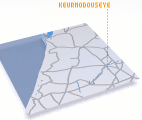 Places with similar names to Keur Modou Sèye, Senegal ::
// Keur Modé Sèye (SN)
Disclaimer :: Information on this page comes without warranty of any kind |
||
|
Where is Keur Modou Sèye? Elevation and coordinates ::
Latitude (lat): 15°16'0"N Longitude (lon): 16°10'0"W
Elevation (approx.): 44m (map arrows pan, magnifying glasses zoom) |
||
|
Visiting Keur Modou Sèye? Hotel/Accommodation ::
Book a hotel in Keur Modou Sèye Travel Guide ::
Buy a travel guide for Senegal rental cars ::
car rental offers GPS waypoint ::
download a GPX waypoint (PoI) of Keur Modou Sèye for your GPS receiver
|
||