|
search place name
|
||
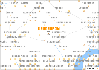
Keur Safadi (Kaolack, Senegal)Keur Safadi is a town in the Kaolack region of Senegal. An overview map of the region around Keur Safadi is displayed below.
regional and 3d topo map of Keur Safadi, Senegal ::
Keur Safadi airports ::
The nearest airport is KLC - Kaolack, located 89.9 km north west of Keur Safadi.
Other airports nearby include BJL - Banjul Intl (158.0 km west), TUD - Tambacounda (176.6 km east), ZIG - Ziguinchor (178.0 km south west), BXO - Bissau Oswaldo Vieira Intl (218.2 km south), Nearby towns ::
Ndakhar-Poste (2.6km south west) //
Bamba Moussa (3.6km east) //
Mbayène Ndakhar (3.6km west) //
Ngouké Kouké (4.1km south east) //
Sintiou Bamba (4.0km south east) //
Taga (4.1km north west) //
Ngouké Diama (5.2km south east) //
Tamba (5.8km north) //
Bamba Mamadou (6.5km north east) //
Mara (7.4km north) //
Makagoui (7.8km south east) //
Ndiok (7.7km north west) //
Ker Chaindu (9.2km south west) //
Méo Ndiayène (9.1km north west) //
Sam (10.3km north east) //
Méo Ndioubène (10.3km north west) //
[all distances 'as the bird flies' and approximate]  Places with similar names to Keur Safadi, Senegal ::
// Krušev Do (BA)
// Cruşovăţ (RO)
// Cruşoviţa (RO)
// Korosavāda (IN)
// Keur Saafadi (SN)
// Gar-e Sefīd (IR)
// Gūr Sefīd (IR)
// Gūr Sefīd (IR)
// Gūr Sefīd (IR)
// Kor Sefīd (IR)
Disclaimer :: Information on this page comes without warranty of any kind |
||
|
Where is Keur Safadi? Elevation and coordinates ::
Latitude (lat): 13°50'0"N Longitude (lon): 15°17'0"W
Elevation (approx.): 53m (map arrows pan, magnifying glasses zoom) |
||
|
Visiting Keur Safadi? Hotel/Accommodation ::
Book a hotel in Keur Safadi Travel Guide ::
Buy a travel guide for Senegal rental cars ::
car rental offers GPS waypoint ::
download a GPX waypoint (PoI) of Keur Safadi for your GPS receiver
|
||