|
search place name
|
||
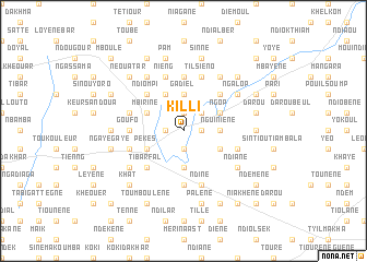
Killi (Thiès, Senegal)Killi is a town in the Thiès region of Senegal. An overview map of the region around Killi is displayed below.
regional and 3d topo map of Killi, Senegal ::
Killi airports ::
The nearest airport is XLS - St. Louis Saint Louis, located 101.9 km north of Killi.
Other airports nearby include KLC - Kaolack (114.9 km south), DKR - Dakar Leopold Sedar Senghor Intl (126.8 km west), BJL - Banjul Intl (200.8 km south), Nearby towns ::
Kouré (1.8km east) //
Beurleup (1.8km east) //
Taïbé (1.9km south) //
Baridiane (1.8km west) //
Ndiadieu (1.9km north) //
Kalom (2.6km north east) //
Nguiniène (3.6km east) //
Ndiargué (3.7km south) //
Gadiel (3.7km north) //
Keur Sini Diao (4.0km south east) //
Ngop (4.0km north east) //
Pékès (4.0km south west) //
Gad Dior (4.1km north west) //
Mbirine (4.0km north west) //
Ngalik (5.2km north east) //
Tibar Fal (5.2km south west) //
Ndiompi (5.2km north west) //
Ndiarde (5.6km north) //
Goufo (5.4km west) //
Ndigo Maï Al (5.6km south) //
Ndièr (5.6km south) //
Til Siéno (5.8km north) //
Keur Mballo (5.7km east) //
Niouki (5.7km west) //
Ndiné (5.8km south) //
Nieng (5.8km north) //
Mbal Fal (5.7km west) //
Siéno (6.6km north east) //
Kangian (6.5km south west) //
[all distances 'as the bird flies' and approximate]  Places with similar names to Killi, Senegal ::
Disclaimer :: Information on this page comes without warranty of any kind |
||
|
Where is Killi? Elevation and coordinates ::
Latitude (lat): 15°8'0"N Longitude (lon): 16°23'0"W
Elevation (approx.): 36m (map arrows pan, magnifying glasses zoom) |
||
|
Visiting Killi? Hotel/Accommodation ::
Book a hotel in Killi Travel Guide ::
Buy a travel guide for Senegal rental cars ::
car rental offers GPS waypoint ::
download a GPX waypoint (PoI) of Killi for your GPS receiver
|
||