|
search place name
|
||
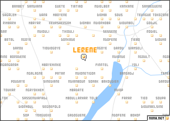
Lérène (Diourbel, Senegal)Lérène is a town in the Diourbel region of Senegal. An overview map of the region around Lérène is displayed below.
regional and 3d topo map of Lérène, Senegal ::
Lérène airports ::
The nearest airport is KLC - Kaolack, located 58.6 km south east of Lérène.
Other airports nearby include DKR - Dakar Leopold Sedar Senghor Intl (125.6 km west), BJL - Banjul Intl (143.8 km south), XLS - St. Louis Saint Louis (161.1 km north), Nearby towns ::
Keur Gane (2.6km south west) //
Ndione Tigom (3.7km south) //
Ngoye (4.0km north east) //
Finntel (4.0km south east) //
Diané (4.1km south west) //
Diam Bougou (5.2km south east) //
Donkadé (5.2km north west) //
Somak (5.8km south) //
Ndione Guel (5.8km north) //
Ndianbour (5.8km south) //
Sobène (5.8km north) //
Lagnar (5.8km north) //
Patar (6.5km south west) //
Ndofène (6.5km north east) //
Tikouli (6.6km north west) //
Ndiande (7.2km east) //
Gourgourène (7.4km north) //
Diomb II (7.4km north) //
Darou (7.4km east) //
Tiodio Goye (7.4km west) //
Mbaye Minké (7.4km west) //
Ndione Kad (7.4km west) //
Mbadate (7.6km south) //
Bakoudièm (7.7km south east) //
Ndione Kad (7.7km north west) //
Séssène (7.7km north east) //
Mbalkane (8.1km south west) //
Ndiorhoba (8.2km north east) //
Sinediane (9.1km south west) //
[all distances 'as the bird flies' and approximate] 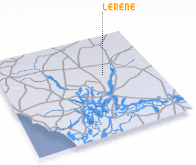 Places with similar names to Lérène, Senegal ::
Disclaimer :: Information on this page comes without warranty of any kind |
||
|
Where is Lérène? Elevation and coordinates ::
Latitude (lat): 14°36'0"N Longitude (lon): 16°20'0"W
Elevation (approx.): 22m (map arrows pan, magnifying glasses zoom) |
||
|
Visiting Lérène? Hotel/Accommodation ::
Book a hotel in Lérène Travel Guide ::
Buy a travel guide for Senegal rental cars ::
car rental offers GPS waypoint ::
download a GPX waypoint (PoI) of Lérène for your GPS receiver
|
||