|
search place name
|
||
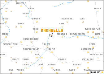
Maka Bella (Kaolack, Senegal)Maka Bella is a town in the Kaolack region of Senegal. An overview map of the region around Maka Bella is displayed below.
regional and 3d topo map of Maka Bella, Senegal ::
Maka Bella airports ::
The nearest airport is KLC - Kaolack, located 88.5 km west of Maka Bella.
Other airports nearby include BJL - Banjul Intl (175.1 km south west), TUD - Tambacounda (175.4 km east), ZIG - Ziguinchor (205.2 km south west), CSK - Cap Skiring (248.6 km south west), Nearby towns ::
Bankouma (3.6km east) //
Tialène (4.1km south west) //
Fass (5.2km north east) //
Malème (5.6km south) //
Taoua (5.7km west) //
Malème Hodar (7.4km west) //
Marlème Hodar (7.4km west) //
Médina Fas (7.7km north east) //
Diam Diam (7.7km north west) //
Diabi (8.2km south west) //
Taïba (9.2km south west) //
Sintié Alenndao (9.1km south west) //
[all distances 'as the bird flies' and approximate] 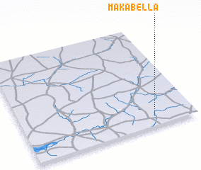 Places with similar names to Maka Bella, Senegal ::
Disclaimer :: Information on this page comes without warranty of any kind |
||
|
Where is Maka Bella? Elevation and coordinates ::
Latitude (lat): 14°6'0"N Longitude (lon): 15°14'0"W
Elevation (approx.): 26m (map arrows pan, magnifying glasses zoom) |
||
|
Visiting Maka Bella? Hotel/Accommodation ::
Book a hotel in Maka Bella Travel Guide ::
Buy a travel guide for Senegal rental cars ::
car rental offers GPS waypoint ::
download a GPX waypoint (PoI) of Maka Bella for your GPS receiver
|
||