|
search place name
|
||
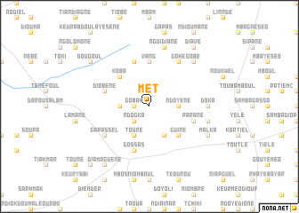
Met (Diourbel, Senegal)Met is a town in the Diourbel region of Senegal. An overview map of the region around Met is displayed below.
regional and 3d topo map of Met, Senegal ::
Met airports ::
The nearest airport is KLC - Kaolack, located 44.6 km south of Met.
Other airports nearby include BJL - Banjul Intl (149.1 km south west), DKR - Dakar Leopold Sedar Senghor Intl (156.6 km west), XLS - St. Louis Saint Louis (171.9 km north), ZIG - Ziguinchor (222.1 km south), Nearby towns ::
Gobak (1.8km west) //
Ngohé (1.9km north) //
Ndogka (2.6km south west) //
Diopam (3.6km west) //
Ndoyène (3.6km east) //
Touré (4.1km south west) //
Téourou Kossom (4.1km south east) //
Koba (5.2km north west) //
Guiné (5.2km south east) //
Vang (5.6km north) //
Loumbel Saye (5.8km north) //
Gossas (5.8km south) //
Parane (5.7km east) //
Diobène (5.7km west) //
Gohé (6.6km north east) //
Gapassel (6.5km south west) //
Doka (7.2km east) //
Keur Abdou Sakor (7.2km east) //
Nguidiane (7.6km north) //
Lagane (7.4km east) //
Gobé (7.7km north east) //
Malka (8.1km south east) //
Dougoul (9.1km north west) //
Diavé (9.2km north east) //
Diamaguène (9.2km south west) //
Gossas Village (10.3km south west) //
[all distances 'as the bird flies' and approximate] 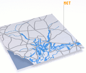 Places with similar names to Met, Senegal ::
Disclaimer :: Information on this page comes without warranty of any kind |
||
|
Where is Met? Elevation and coordinates ::
Latitude (lat): 14°33'0"N Longitude (lon): 16°3'0"W
Elevation (approx.): 35m (map arrows pan, magnifying glasses zoom) |
||
|
Visiting Met? Hotel/Accommodation ::
Book a hotel in Met Travel Guide ::
Buy a travel guide for Senegal rental cars ::
car rental offers GPS waypoint ::
download a GPX waypoint (PoI) of Met for your GPS receiver
|
||