|
search place name
|
||
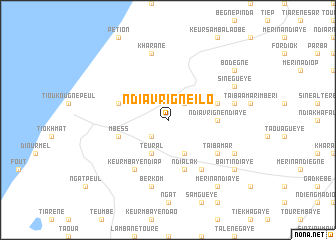
Ndiavrigne Ilo (Louga, Senegal)Ndiavrigne Ilo is a town in the Louga region of Senegal. An overview map of the region around Ndiavrigne Ilo is displayed below.
regional and 3d topo map of Ndiavrigne Ilo, Senegal ::
Ndiavrigne Ilo airports ::
The nearest airport is XLS - St. Louis Saint Louis, located 70.7 km north of Ndiavrigne Ilo.
Other airports nearby include DKR - Dakar Leopold Sedar Senghor Intl (119.9 km south west), KLC - Kaolack (155.5 km south east), Nearby towns ::
Ndiavrigne Samoad (2.6km south west) //
Niou Sogui (2.6km south west) //
Ngaraf (2.6km north east) //
Ndiavrigne Paté (4.1km south east) //
Teural (4.1km south west) //
Ndiavrigne Ndiaye (5.4km east) //
Ndialak (5.8km south) //
Diavrigne Amari (5.8km south) //
Mbèss (5.7km west) //
Lompoul (5.7km west) //
Sam Gueye (5.7km east) //
Makali (6.6km south east) //
Taïba Mar (6.5km south east) //
Keur Mbaye Ndiap (6.6km south west) //
Berkom (7.6km south) //
Diokoul Ndiaye (7.4km east) //
Kharane (7.6km north) //
Sène Madembaleye (8.1km south east) //
Sine Gueye (8.0km north east) //
Mérina Ndiaye (9.1km south east) //
Baïti Ndiaye (9.1km south east) //
Bodègne (9.1km north east) //
[all distances 'as the bird flies' and approximate] 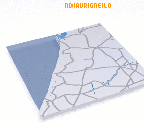 Places with similar names to Ndiavrigne Ilo, Senegal :: Disclaimer :: Information on this page comes without warranty of any kind |
||
|
Where is Ndiavrigne Ilo? Elevation and coordinates ::
Latitude (lat): 15°26'0"N Longitude (lon): 16°38'0"W
Elevation (approx.): 30m (map arrows pan, magnifying glasses zoom) |
||
|
Visiting Ndiavrigne Ilo? Hotel/Accommodation ::
Book a hotel in Ndiavrigne Ilo Travel Guide ::
Buy a travel guide for Senegal rental cars ::
car rental offers GPS waypoint ::
download a GPX waypoint (PoI) of Ndiavrigne Ilo for your GPS receiver
|
||