|
search place name
|
||
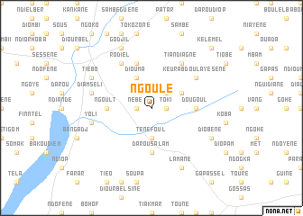
Ngoulé (Diourbel, Senegal)Ngoulé is a town in the Diourbel region of Senegal. An overview map of the region around Ngoulé is displayed below.
regional and 3d topo map of Ngoulé, Senegal ::
Ngoulé airports ::
The nearest airport is KLC - Kaolack, located 51.7 km south of Ngoulé.
Other airports nearby include DKR - Dakar Leopold Sedar Senghor Intl (143.4 km west), BJL - Banjul Intl (149.2 km south), XLS - St. Louis Saint Louis (163.7 km north), Nearby towns ::
Nébé (1.8km west) //
Toki (1.8km east) //
Belki (2.6km north east) //
Ténéfoul (3.7km south) //
Diouma (4.1km north west) //
Diaoré (4.0km north east) //
Ngolomone (4.0km north east) //
Darou Salam (5.6km south) //
Dougoul (5.4km east) //
Ngoult (5.4km west) //
Dabel Bara (5.8km north) //
Rodiel (6.6km north west) //
Keur Abdoulaye Sènè (6.5km north east) //
Diakaèl (6.5km north east) //
Tiandiagne (6.6km north east) //
Yoli (7.4km west) //
Diam Séli (7.4km west) //
Tiébo (8.1km north west) //
Diobène (8.1km south east) //
Godjil (8.2km north west) //
Lamane (8.2km south east) //
Diabel (8.2km south east) //
Kélémel (10.3km north east) //
[all distances 'as the bird flies' and approximate] 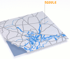 Places with similar names to Ngoulé, Senegal ::
Disclaimer :: Information on this page comes without warranty of any kind |
||
|
Where is Ngoulé? Elevation and coordinates ::
Latitude (lat): 14°36'0"N Longitude (lon): 16°10'0"W
Elevation (approx.): 23m (map arrows pan, magnifying glasses zoom) |
||
|
Visiting Ngoulé? Hotel/Accommodation ::
Book a hotel in Ngoulé Travel Guide ::
Buy a travel guide for Senegal rental cars ::
car rental offers GPS waypoint ::
download a GPX waypoint (PoI) of Ngoulé for your GPS receiver
|
||