|
search place name
|
||
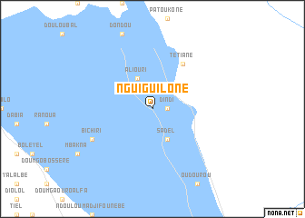
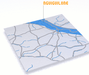
Nguiguilone (Saint-Louis, Senegal)Nguiguilone is a town in the Saint-Louis region of Senegal. An overview map of the region around Nguiguilone is displayed below.
regional and 3d topo map of Nguiguilone, Senegal ::
Nguiguilone airports ::
The nearest airport is KED - Kaedi, located 30.2 km north west of Nguiguilone.
Other airports nearby include SEY - Selibabi Selibady (148.3 km south east), BXE - Bakel (153.0 km south east), KFA - Kiffa (220.1 km east), KYS - Kayes Dag Dag (263.7 km south east), Nearby towns ::
 Places with similar names to Nguiguilone, Senegal ::
// Ngqeleni (ZA)
// Ngqeleni (ZA)
// Ngogalen (GA)
// Nkogalène (GA)
// Nāg Kalān (PK)
// Naieke Kalān (PK)
// Nakka Kalān (PK)
// Nakka Kalān (PK)
// Ngọc Lãnh (VN)
// Ngọc Liễn (VN)
Disclaimer :: Information on this page comes without warranty of any kind |
||
|
Where is Nguiguilone? Elevation and coordinates ::
Latitude (lat): 15°56'0"N Longitude (lon): 13°21'0"W
Elevation (approx.): 18m (map arrows pan, magnifying glasses zoom) |
||
|
Visiting Nguiguilone? Hotel/Accommodation ::
Book a hotel in Nguiguilone Travel Guide ::
Buy a travel guide for Senegal rental cars ::
car rental offers GPS waypoint ::
download a GPX waypoint (PoI) of Nguiguilone for your GPS receiver
|
||