|
search place name
|
||
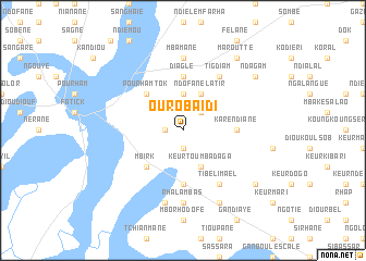
Ouro Baïdi (Fatick, Senegal)Ouro Baïdi is a town in the Fatick region of Senegal. An overview map of the region around Ouro Baïdi is displayed below.
regional and 3d topo map of Ouro Baïdi, Senegal ::
Ouro Baïdi airports ::
The nearest airport is KLC - Kaolack, located 34.3 km south east of Ouro Baïdi.
Other airports nearby include BJL - Banjul Intl (114.2 km south), DKR - Dakar Leopold Sedar Senghor Intl (134.9 km west), XLS - St. Louis Saint Louis (192.5 km north), ZIG - Ziguinchor (194.9 km south), Nearby towns ::
Fouial Sinndi (1.8km west) //
Guidine (1.8km west) //
Sakao (1.9km south) //
Mbelakadio (2.6km north east) //
Latir (3.7km north) //
Ndofane Latir (4.1km north east) //
Keur Toumba Daga (4.1km south east) //
Pourham Tok (5.2km north west) //
Mbirk (5.2km south west) //
Diaglé (5.6km north) //
Keur Alfa (5.6km south) //
Kare Ndiane (5.4km east) //
Ngouloul (5.6km south) //
Tigdiam (6.6km north east) //
Tibeli Mael (6.6km south east) //
Mbamane (7.4km north) //
Rhalambas (7.4km south) //
Keur Bakari Touré (7.6km south) //
Bélongui (8.2km south east) //
Maroutte (9.2km north east) //
Ndagam (9.1km north east) //
Mbelbouk (9.1km south east) //
[all distances 'as the bird flies' and approximate] 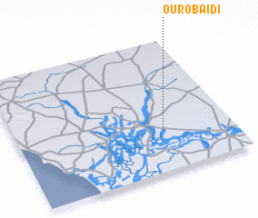 Places with similar names to Ouro Baïdi, Senegal ::
Disclaimer :: Information on this page comes without warranty of any kind |
||
|
Where is Ouro Baïdi? Elevation and coordinates ::
Latitude (lat): 14°19'0"N Longitude (lon): 16°19'0"W
Elevation (approx.): 14m (map arrows pan, magnifying glasses zoom) |
||
|
Visiting Ouro Baïdi? Hotel/Accommodation ::
Book a hotel in Ouro Baïdi Travel Guide ::
Buy a travel guide for Senegal rental cars ::
car rental offers GPS waypoint ::
download a GPX waypoint (PoI) of Ouro Baïdi for your GPS receiver
|
||