|
search place name
|
||
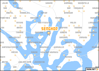
Senghor (Fatick, Senegal)Senghor is a town in the Fatick region of Senegal. An overview map of the region around Senghor is displayed below.
regional and 3d topo map of Senghor, Senegal ::
Senghor airports ::
The nearest airport is KLC - Kaolack, located 57.5 km south east of Senghor.
Other airports nearby include DKR - Dakar Leopold Sedar Senghor Intl (111.4 km west), BJL - Banjul Intl (118.4 km south), XLS - St. Louis Saint Louis (182.7 km north), ZIG - Ziguinchor (205.6 km south), Nearby towns ::
Ngodjélèm (2.6km north west) //
Ndafène (3.6km west) //
Mbetit Gouye (4.1km north west) //
Sobène (5.4km east) //
Diouroup (5.8km south) //
Sangare (5.7km east) //
Ndofane (5.7km east) //
Diob Ndiafène (6.5km south west) //
Diakhère (6.6km north east) //
Mokane (6.6km north east) //
Diongolor (6.6km south east) //
Konèm (7.2km east) //
Dioulouf Doundou (7.4km south) //
Ndofène (7.4km west) //
Kotior (7.6km north) //
Bikol (7.4km east) //
Mbédape (7.7km north west) //
Mboukoutour (8.1km north east) //
Mbane (8.1km south east) //
Ngouye (8.1km south east) //
Kamiak (8.2km north west) //
Dioudiouf (9.2km south east) //
Niagne (9.2km south west) //
Binandar (10.3km north east) //
[all distances 'as the bird flies' and approximate] 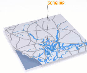 Places with similar names to Senghor, Senegal ::
Disclaimer :: Information on this page comes without warranty of any kind |
||
|
Where is Senghor? Elevation and coordinates ::
Latitude (lat): 14°24'0"N Longitude (lon): 16°31'0"W
Elevation (approx.): 7m (map arrows pan, magnifying glasses zoom) |
||
|
Visiting Senghor? Hotel/Accommodation ::
Book a hotel in Senghor Travel Guide ::
Buy a travel guide for Senegal rental cars ::
car rental offers GPS waypoint ::
download a GPX waypoint (PoI) of Senghor for your GPS receiver
|
||