|
search place name
|
||
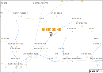
Sibi Nokho (Kaolack, Senegal)Sibi Nokho is a town in the Kaolack region of Senegal. An overview map of the region around Sibi Nokho is displayed below.
regional and 3d topo map of Sibi Nokho, Senegal ::
Sibi Nokho airports ::
The nearest airport is TUD - Tambacounda, located 120.6 km east of Sibi Nokho.
Other airports nearby include KLC - Kaolack (144.4 km west), BJL - Banjul Intl (224.4 km west), ZIG - Ziguinchor (238.1 km south west), XLS - St. Louis Saint Louis (288.9 km north west), Nearby towns ::
Koundo (2.6km south west) //
Keur Ngaye (5.2km south west) //
Keur Galo (5.8km north) //
Taba (5.8km south) //
Touba (6.6km north west) //
Touba Ngouye (6.6km south west) //
Ndioum (6.6km south east) //
Bélel Babo (7.6km north) //
Pir Nango (7.4km east) //
Tako (7.6km south) //
Ndioum (9.2km south east) //
Darou (9.2km south west) //
Darou Tiéguène (10.3km south west) //
[all distances 'as the bird flies' and approximate] 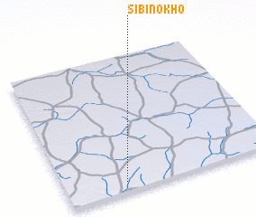 Places with similar names to Sibi Nokho, Senegal :: Disclaimer :: Information on this page comes without warranty of any kind |
||
|
Where is Sibi Nokho? Elevation and coordinates ::
Latitude (lat): 14°4'0"N Longitude (lon): 14°43'0"W
Elevation (approx.): 32m (map arrows pan, magnifying glasses zoom) |
||
|
Visiting Sibi Nokho? Hotel/Accommodation ::
Book a hotel in Sibi Nokho Travel Guide ::
Buy a travel guide for Senegal rental cars ::
car rental offers GPS waypoint ::
download a GPX waypoint (PoI) of Sibi Nokho for your GPS receiver
|
||