|
search place name
|
||
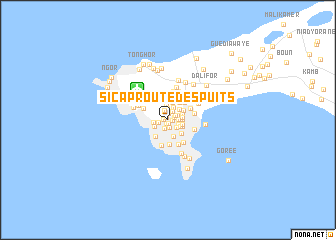
S.I.C.A.P. Route des PUITS (Dakar, Senegal)S.I.C.A.P. Route des PUITS is a town in the Dakar region of Senegal. An overview map of the region around S.I.C.A.P. Route des PUITS is displayed below.
regional and 3d topo map of S.I.C.A.P. Route des PUITS, Senegal ::
S.I.C.A.P. Route des PUITS airports ::
The nearest airport is DKR - Dakar Leopold Sedar Senghor Intl, located 4.7 km north west of S.I.C.A.P. Route des PUITS.
Other airports nearby include KLC - Kaolack (164.1 km east), BJL - Banjul Intl (175.0 km south east), XLS - St. Louis Saint Louis (183.0 km north east), Nearby towns ::
S.I.C.A.P. Liberté Un (0.3km north west) //
S.I.C.A.P. Amitié Un (0.4km south west) //
S.I.C.A.P. Rue Dix (0.4km south) //
S.I.C.A.P. Baobabs (0.4km west) //
Grand Dakar (0.5km east) //
S.I.C.A.P. Liberté Deux (0.7km north) //
Niari Tali (0.8km east) //
S.I.C.A.P. Amitié Deux (0.9km south) //
Quartier Usine (1.0km north east) //
Point E (1.0km south) //
S.I.C.A.P. Karak (1.0km west) //
S.I.C.A.P. Sacré-Cœur (1.1km north) //
S.I.C.A.P. Liberté Trois (1.1km north east) //
Ouagou Niaye (1.1km east) //
Bène Tali (1.2km north east) //
Bop (1.2km south east) //
Cerf-Volant (1.3km south east) //
S.I.C.A.P. Liberté Quatre (1.3km north) //
S.I.C.A.P. Dieupeul (1.6km north east) //
Cité du Port de Commerce (1.5km south east) //
H.L.M. Quatre (1.6km east) //
S.I.C.A.P. Liberté Çinq (1.6km north) //
H.L.M. Çinq (1.6km east) //
H.L.M. Six Nimzat (1.6km east) //
S.I.C.A.P. Mermoz (1.6km west) //
H.L.M. Trois (1.6km east) //
Fenêtre Mermoz (1.7km south west) //
Usine Parc (1.7km north east) //
Cité de la Douane (1.7km south east) //
[all distances 'as the bird flies' and approximate] 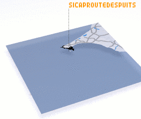 Places with similar names to S.I.C.A.P. Route des PUITS, Senegal :: Disclaimer :: Information on this page comes without warranty of any kind |
||
|
Where is S.I.C.A.P. Route des PUITS? Elevation and coordinates ::
Latitude (lat): 14°42'33"N Longitude (lon): 17°27'35"W
Elevation (approx.): 26m (map arrows pan, magnifying glasses zoom) |
||
|
Visiting S.I.C.A.P. Route des PUITS? Hotel/Accommodation ::
Book a hotel in S.I.C.A.P. Route des PUITS Travel Guide ::
Buy a travel guide for Senegal rental cars ::
car rental offers GPS waypoint ::
download a GPX waypoint (PoI) of S.I.C.A.P. Route des PUITS for your GPS receiver
|
||