|
search place name
|
||
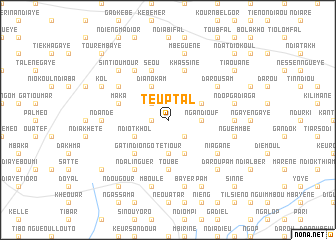
Teuptal (Thiès, Senegal)Teuptal is a town in the Thiès region of Senegal. An overview map of the region around Teuptal is displayed below.
regional and 3d topo map of Teuptal, Senegal ::
Teuptal airports ::
The nearest airport is XLS - St. Louis Saint Louis, located 86.8 km north of Teuptal.
Other airports nearby include DKR - Dakar Leopold Sedar Senghor Intl (127.7 km south west), KLC - Kaolack (130.6 km south), BJL - Banjul Intl (214.7 km south), Nearby towns ::
Dienné Rat (1.8km west) //
Guéye Guéye (2.6km north west) //
Tiavène (2.6km south east) //
Ngandiouf (3.6km east) //
Mbarène (3.6km east) //
Tétiour (3.7km south) //
Ndiobène Taye (4.0km north east) //
Diano Kam (4.1km north west) //
Diokoul (4.1km south east) //
Ndiot Khol (4.0km south west) //
Gati Ndiongo (5.2km south west) //
Toubé (5.6km south) //
Maka (5.7km west) //
Dienné (5.7km west) //
Khassine (5.8km north) //
Séou (5.8km north) //
Darou Sam (6.5km north east) //
Gad Bitiou (6.5km north west) //
Ndar Sal (6.5km south east) //
Bitiou (6.6km north west) //
Ndalinguèr (6.6km south west) //
Niagane (6.5km south east) //
Ndigué (7.2km east) //
Ndande (7.2km west) //
Mbéguène (7.6km north) //
Ndop Gadiaga (7.4km east) //
Nguemmbé (7.4km east) //
Bayèr (7.6km south) //
Mboulé (7.6km south) //
[all distances 'as the bird flies' and approximate]  Places with similar names to Teuptal, Senegal ::
Disclaimer :: Information on this page comes without warranty of any kind |
||
|
Where is Teuptal? Elevation and coordinates ::
Latitude (lat): 15°16'0"N Longitude (lon): 16°26'0"W
Elevation (approx.): 41m (map arrows pan, magnifying glasses zoom) |
||
|
Visiting Teuptal? Hotel/Accommodation ::
Book a hotel in Teuptal Travel Guide ::
Buy a travel guide for Senegal rental cars ::
car rental offers GPS waypoint ::
download a GPX waypoint (PoI) of Teuptal for your GPS receiver
|
||