|
search place name
|
||
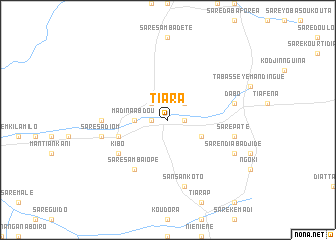
Tiara (Kolda, Senegal)Tiara is a town in the Kolda region of Senegal. An overview map of the region around Tiara is displayed below.
regional and 3d topo map of Tiara, Senegal ::
Tiara airports ::
The nearest airport is TUD - Tambacounda, located 136.8 km north east of Tiara.
Other airports nearby include BXO - Bissau Oswaldo Vieira Intl (161.1 km south west), ZIG - Ziguinchor (191.2 km west), KLC - Kaolack (215.6 km north west), Nearby towns ::
Saré Ogo (1.8km east) //
Saré Kounda (1.8km west) //
Oundoumané (2.6km north west) //
Dialambéré (2.6km north east) //
Madina Abdou (3.6km west) //
Koumambouré Maoundé (4.1km south east) //
Kampissa (5.7km west) //
Saré Samba Iopé (6.6km south west) //
Kibo (6.6km south west) //
Likéringto (7.2km west) //
Dabo (7.5km east) //
Saré Sadiom (7.5km west) //
Sansankoto (7.6km south) //
Saré Paté (7.5km east) //
Saré Ndiaba Djidé (8.1km south east) //
[all distances 'as the bird flies' and approximate] 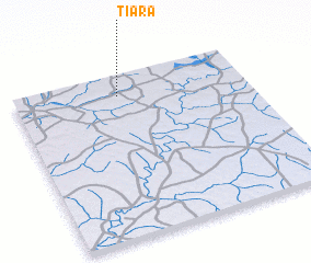 Places with similar names to Tiara, Senegal ::
Disclaimer :: Information on this page comes without warranty of any kind |
||
|
Where is Tiara? Elevation and coordinates ::
Latitude (lat): 12°52'0"N Longitude (lon): 14°33'0"W
Elevation (approx.): 36m (map arrows pan, magnifying glasses zoom) |
||
|
Visiting Tiara? Hotel/Accommodation ::
Book a hotel in Tiara Travel Guide ::
Buy a travel guide for Senegal rental cars ::
car rental offers GPS waypoint ::
download a GPX waypoint (PoI) of Tiara for your GPS receiver
|
||