|
search place name
|
||
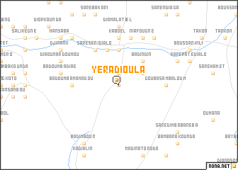
Yéra Dioula (Kolda, Senegal)Yéra Dioula is a town in the Kolda region of Senegal. An overview map of the region around Yéra Dioula is displayed below.
regional and 3d topo map of Yéra Dioula, Senegal ::
Yéra Dioula airports ::
The nearest airport is ZIG - Ziguinchor, located 97.6 km south west of Yéra Dioula.
Other airports nearby include BJL - Banjul Intl (109.9 km west), KLC - Kaolack (115.1 km north), BXO - Bissau Oswaldo Vieira Intl (142.5 km south), CSK - Cap Skiring (146.6 km south west), Nearby towns ::
Ndiolofène (0.0km north) //
Saré Babou (1.9km north) //
Koutounta Ali Koli (4.1km north east) //
Badindin (5.2km north east) //
Boufara Gor (5.6km north) //
Kandimba (5.8km north) //
Saré Séni Dialo (6.6km north west) //
Badoumba Mamadou (7.2km west) //
Gouba Samba Loum (7.2km east) //
Kaboél (7.4km north) //
Koboel (7.6km north) //
Niafougne (8.2km north east) //
Kolikounda (9.2km north east) //
Banéba (10.3km north west) //
[all distances 'as the bird flies' and approximate] 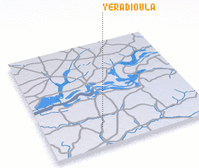 Places with similar names to Yéra Dioula, Senegal ::
// Yaradullu (AZ)
// Yardelle (US)
// Yardley (US)
// Yaradou Lé (GN)
// Yertula (TJ)
// Yardley (US)
// Yardley (GB)
// Yérétiélé (CI)
// Youorédoula (CI)
Disclaimer :: Information on this page comes without warranty of any kind |
||
|
Where is Yéra Dioula? Elevation and coordinates ::
Latitude (lat): 13°11'0"N Longitude (lon): 15°39'0"W
Elevation (approx.): 28m (map arrows pan, magnifying glasses zoom) |
||
|
Visiting Yéra Dioula? Hotel/Accommodation ::
Book a hotel in Yéra Dioula Travel Guide ::
Buy a travel guide for Senegal rental cars ::
car rental offers GPS waypoint ::
download a GPX waypoint (PoI) of Yéra Dioula for your GPS receiver
|
||