|
search place name
|
||
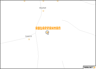
‘Abd ar Raḩmān (Kurdufān, Sudan)‘Abd ar Raḩmān is a town in the Kurdufān region of Sudan. An overview map of the region around ‘Abd ar Raḩmān is displayed below.
regional and 3d topo map of ‘Abd ar Raḩmān, Sudan ::
‘Abd ar Raḩmān airports ::
The nearest airport is EBD - El Obeid, located 84.4 km south west of ‘Abd ar Raḩmān.
Nearby towns ::
Ţuwayr (7.4km west) //
[all distances 'as the bird flies' and approximate]  Places with similar names to ‘Abd ar Raḩmān, Sudan ::
// Abdurrahman (TR)
// Ābdarmīān (IR)
// Abdur Rahmān (PK)
// Abdur Rahmān (PK)
// Abdur Rahmān (PK)
// Abdur Rahmān (PK)
// Abdourahmane (ML)
// ‘Abd or Raḩmān (IR)
// ‘Abd ar Raḩmān (SD)
// Abderahmane (MA)
Disclaimer :: Information on this page comes without warranty of any kind |
||
|
Where is ‘Abd ar Raḩmān? Elevation and coordinates ::
Latitude (lat): 13°27'0"N Longitude (lon): 30°57'0"E
Elevation (approx.): 464m (map arrows pan, magnifying glasses zoom) |
||
|
Visiting ‘Abd ar Raḩmān? Hotel/Accommodation ::
Book a hotel in ‘Abd ar Raḩmān Travel Guide ::
Buy a travel guide for Sudan rental cars ::
car rental offers GPS waypoint ::
download a GPX waypoint (PoI) of ‘Abd ar Raḩmān for your GPS receiver
|
||