|
search place name
|
||
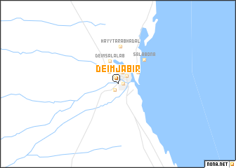
Deim Jābir ((( Ash Sharqīyah )), Sudan)Deim Jābir is a town in the (( Ash Sharqīyah )) region of Sudan. An overview map of the region around Deim Jābir is displayed below.
regional and 3d topo map of Deim Jābir, Sudan ::
Nearby towns ::
Deim Mūsá (0.8km east) //
Deim ‘Arab (1.1km north) //
Deim Kūryā (1.1km south west) //
Būr Sūdān (1.8km north east) //
West Town (2.0km north) //
Deim Madīna (2.3km north west) //
Ḩayy al ‘Az̧amah (2.9km north) //
Abū Ḩashīsh (3.6km north east) //
Deim Salālāb (3.8km north) //
Salābōnā (5.5km north east) //
Ḩayy Tarab Hadal (6.0km north) //
[all distances 'as the bird flies' and approximate] 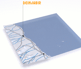 Places with similar names to Deim Jābir, Sudan :: Disclaimer :: Information on this page comes without warranty of any kind |
||
|
Where is Deim Jābir? Elevation and coordinates ::
Latitude (lat): 19°36'17"N Longitude (lon): 37°12'14"E
Elevation (approx.): 11m (map arrows pan, magnifying glasses zoom) |
||
|
Visiting Deim Jābir? Hotel/Accommodation ::
Book a hotel in Deim Jābir Travel Guide ::
Buy a travel guide for Sudan rental cars ::
car rental offers GPS waypoint ::
download a GPX waypoint (PoI) of Deim Jābir for your GPS receiver
|
||