|
search place name
|
||
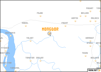
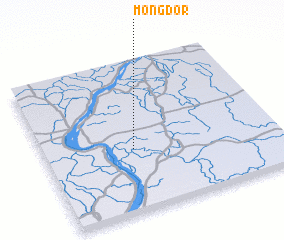
Mongdor (Sudan)Mongdor is a town in Sudan. An overview map of the region around Mongdor is displayed below.
regional and 3d topo map of Mongdor, Sudan ::
Mongdor airports ::
The nearest airport is MAK - Malakal, located 124.2 km south west of Mongdor.
Nearby towns ::
 Places with similar names to Mongdor, Sudan ::
// Maungatiro (NZ)
// Mangodara (BF)
// Mangadyr (KZ)
// Māngūtāru (PK)
// Miāni Qattār (PK)
// Mangotara (HN)
// Mano Kotor (GM)
// Mangdo-ri (KP)
// Mangdo-ri (KP)
// Mường Trai (VN)
Disclaimer :: Information on this page comes without warranty of any kind |
||
|
Where is Mongdor? Elevation and coordinates ::
Latitude (lat): 10°25'0"N Longitude (lon): 32°23'0"E
Elevation (approx.): 390m (map arrows pan, magnifying glasses zoom) |
||
|
Visiting Mongdor? Hotel/Accommodation ::
Book a hotel in Mongdor Travel Guide ::
Buy a travel guide for Sudan rental cars ::
car rental offers GPS waypoint ::
download a GPX waypoint (PoI) of Mongdor for your GPS receiver
|
||