|
search place name
|
||
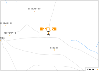
Umm Tur‘ah (Kurdufān, Sudan)Umm Tur‘ah is a town in the Kurdufān region of Sudan. An overview map of the region around Umm Tur‘ah is displayed below.
regional and 3d topo map of Umm Tur‘ah, Sudan ::
Umm Tur‘ah airports ::
The nearest airport is EBD - El Obeid, located 169.9 km south west of Umm Tur‘ah.
Other airports nearby include KRT - Khartoum (200.2 km north east), Nearby towns ::
Umm Daymayn (2.6km north west) //
Umm Sayyālah (2.6km north east) //
Umm Bawl (5.8km south) //
[all distances 'as the bird flies' and approximate] 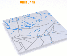 Places with similar names to Umm Tur‘ah, Sudan ::
// Umm ad Dayrī (IQ)
// Ummattūr (IN)
// Umm Badr (SD)
// Umm Madār (SY)
// Umuaturu (NG)
// Umudara (NG)
// Umu Duru (NG)
// Ŭmdae-ri (KR)
// Umm Madārah (YE)
Disclaimer :: Information on this page comes without warranty of any kind |
||
|
Where is Umm Tur‘ah? Elevation and coordinates ::
Latitude (lat): 14°24'0"N Longitude (lon): 31°9'0"E
Elevation (approx.): 413m (map arrows pan, magnifying glasses zoom) |
||
|
Visiting Umm Tur‘ah? Hotel/Accommodation ::
Book a hotel in Umm Tur‘ah Travel Guide ::
Buy a travel guide for Sudan rental cars ::
car rental offers GPS waypoint ::
download a GPX waypoint (PoI) of Umm Tur‘ah for your GPS receiver
|
||