|
search place name
|
||
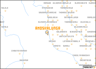
Amos Kalunga (Central, Zambia)Amos Kalunga is a town in the Central region of Zambia. An overview map of the region around Amos Kalunga is displayed below.
regional and 3d topo map of Amos Kalunga, Zambia ::
Amos Kalunga airports ::
The nearest airport is NLA - Ndola, located 174.3 km west of Amos Kalunga.
Other airports nearby include MFU - Mfuwe (185.8 km east), Nearby towns ::
Kantontoka (NaNkm north) //
Mulelo (NaNkm north) //
Meli Mwelwa (1.8km east) //
Samwell Kampeshi (1.8km east) //
Chibuye Mwando (1.9km north) //
Mambwe Chisenda (1.8km east) //
Franki Chisenga (2.6km north east) //
Aleshi Chisenda (2.6km north east) //
Elisa Mwape (2.6km north east) //
Joni Bwale (2.6km north east) //
Chibuye Lisandi (2.6km north east) //
Namushasal (2.6km south east) //
Aleshi Flaichangwe (3.7km north) //
Sula Musonda Mulu (3.7km north) //
Nakapapa (3.6km east) //
Nasaioni (3.6km east) //
Mwape Mapulanga (4.1km north east) //
David Kasuba (4.1km north east) //
Saioni Mabuluchi (4.1km north east) //
Mataka (4.1km south east) //
Nakatontoka (5.6km north) //
Solo Maiani (5.4km east) //
Sande Mulungwe (5.4km east) //
Tom Oliashi (5.8km north) //
Mwape Mbusha (5.8km north) //
Thomas Chiseshia (5.8km north) //
Namelika (5.7km east) //
Nai Esaia (5.8km north) //
Kamoyo (6.6km south east) //
[all distances 'as the bird flies' and approximate]  Places with similar names to Amos Kalunga, Zambia :: Disclaimer :: Information on this page comes without warranty of any kind |
||
|
Where is Amos Kalunga? Elevation and coordinates ::
Latitude (lat): 12°53'0"S Longitude (lon): 30°16'0"E
Elevation (approx.): 1259m (map arrows pan, magnifying glasses zoom) |
||
|
Visiting Amos Kalunga? Hotel/Accommodation ::
Book a hotel in Amos Kalunga Travel Guide ::
Buy a travel guide for Zambia rental cars ::
car rental offers GPS waypoint ::
download a GPX waypoint (PoI) of Amos Kalunga for your GPS receiver
|
||