|
search place name
|
||
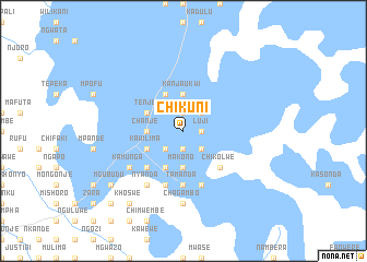
Chikuni (Eastern, Zambia)Chikuni is a town in the Eastern region of Zambia. An overview map of the region around Chikuni is displayed below.
regional and 3d topo map of Chikuni, Zambia ::
Chikuni airports ::
The nearest airport is MFU - Mfuwe, located 103.5 km west of Chikuni.
Other airports nearby include LLW - Lilongwe Kamuzu Intl (107.0 km south east), ZZU - Mzuzu (247.1 km north east), Nearby towns ::
Chisambo (1.9km north) //
Chiziwa (1.9km south) //
Kasegula (1.9km south) //
Luji (1.8km east) //
Zoroka (2.6km south west) //
Chisanku (2.6km north east) //
Kabibi (2.6km north east) //
Katema (2.6km south east) //
Chanje (3.6km west) //
Kanjaukwi (3.7km north) //
Makono (3.7km south) //
Jaoli (3.7km south) //
Tenje (4.1km north west) //
Kamamina (4.1km north west) //
Changata (4.1km south west) //
Jones (4.1km south west) //
Kawilima (4.1km south west) //
Dzoole (4.1km south west) //
Katsekula (4.1km south west) //
Chindime (5.2km south west) //
Chikolwe (5.2km south east) //
Tamanda (5.6km south) //
Mpara (5.8km south) //
Chimtenje (5.8km south) //
Chikweta (5.8km south) //
Kamwenje (5.8km south) //
Kazonga (5.8km south) //
Ngubudu (6.6km south west) //
Nyanda (6.6km south west) //
[all distances 'as the bird flies' and approximate] 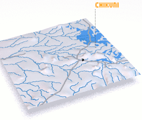 Places with similar names to Chikuni, Zambia ::
Disclaimer :: Information on this page comes without warranty of any kind |
||
|
Where is Chikuni? Elevation and coordinates ::
Latitude (lat): 13°23'0"S Longitude (lon): 32°53'0"E
Elevation (approx.): 1082m (map arrows pan, magnifying glasses zoom) |
||
|
Visiting Chikuni? Hotel/Accommodation ::
Book a hotel in Chikuni Travel Guide ::
Buy a travel guide for Zambia rental cars ::
car rental offers GPS waypoint ::
download a GPX waypoint (PoI) of Chikuni for your GPS receiver
|
||