|
search place name
|
||
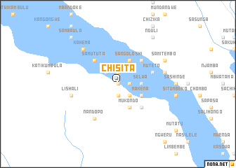
Chisita (Western, Zambia)Chisita is a town in the Western region of Zambia. An overview map of the region around Chisita is displayed below.
regional and 3d topo map of Chisita, Zambia ::
Nearby towns ::
Kabeu (0.0km north) //
Mukuwa (0.0km north) //
Minyongi (1.9km south) //
Kalezhi (1.8km east) //
Sikufa (1.9km north) //
Kangwanda (2.6km south east) //
Kalwizi (2.6km south east) //
Kungu (2.6km south east) //
Sete (2.6km north west) //
Selwa (3.6km east) //
Makena (4.0km south east) //
Mukondo (4.1km south east) //
Sangoloshi (4.1km north east) //
Lulembwana (5.2km south east) //
Lilema (5.2km north east) //
Samututa (5.2km north west) //
Muteto (5.7km east) //
Limbwi (5.7km east) //
Nandopo (6.6km south west) //
Katenga (7.4km east) //
Lishali (7.4km west) //
Kahema (7.7km north west) //
Lipemba (8.1km north east) //
Samitembo (8.1km north east) //
Muyangwa (8.1km north east) //
Kauwala (9.2km north east) //
Nduli (9.2km north east) //
Sambaula (10.3km north west) //
Likumumu (10.3km north west) //
[all distances 'as the bird flies' and approximate]  Places with similar names to Chisita, Zambia ::
Disclaimer :: Information on this page comes without warranty of any kind |
||
|
Where is Chisita? Elevation and coordinates ::
Latitude (lat): 14°7'0"S Longitude (lon): 22°52'0"E
Elevation (approx.): 1053m (map arrows pan, magnifying glasses zoom) |
||
|
Visiting Chisita? Hotel/Accommodation ::
Book a hotel in Chisita Travel Guide ::
Buy a travel guide for Zambia rental cars ::
car rental offers GPS waypoint ::
download a GPX waypoint (PoI) of Chisita for your GPS receiver
|
||