|
search place name
|
||
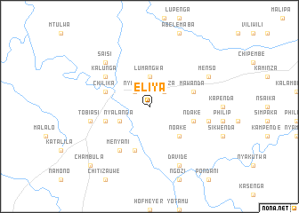
Eliya (Eastern, Zambia)Eliya is a town in the Eastern region of Zambia. An overview map of the region around Eliya is displayed below.
regional and 3d topo map of Eliya, Zambia ::
Eliya airports ::
The nearest airport is MFU - Mfuwe, located 186.3 km north east of Eliya.
Other airports nearby include KAB - Kariba Intl (301.9 km south west), Nearby towns ::
Kanduza (2.6km north east) //
Nyimba (2.6km north west) //
Lumangwa (3.7km north) //
Nyalanga (4.0km south west) //
Noake (5.2km south east) //
Ndake (5.7km east) //
Kanyama (5.7km west) //
Mawanda (5.7km east) //
Chambwe (5.8km south) //
Nyankwaya (5.7km west) //
Chilika (5.7km west) //
Menyani (6.6km south west) //
Kalunga (6.5km north west) //
Kamphata (7.4km east) //
Tobiasi (7.4km west) //
Saisi (7.7km north west) //
Davide (8.2km south east) //
Menso (8.1km north east) //
Chambula (10.3km south west) //
[all distances 'as the bird flies' and approximate] 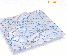 Places with similar names to Eliya, Zambia ::
Disclaimer :: Information on this page comes without warranty of any kind |
||
|
Where is Eliya? Elevation and coordinates ::
Latitude (lat): 14°34'0"S Longitude (lon): 30°51'0"E
Elevation (approx.): 750m (map arrows pan, magnifying glasses zoom) |
||
|
Visiting Eliya? Hotel/Accommodation ::
Book a hotel in Eliya Travel Guide ::
Buy a travel guide for Zambia rental cars ::
car rental offers GPS waypoint ::
download a GPX waypoint (PoI) of Eliya for your GPS receiver
|
||