|
search place name
|
||
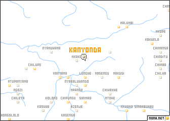
Kanyonda (Eastern, Zambia)Kanyonda is a town in the Eastern region of Zambia. An overview map of the region around Kanyonda is displayed below.
regional and 3d topo map of Kanyonda, Zambia ::
Kanyonda airports ::
The nearest airport is MFU - Mfuwe, located 107.1 km north east of Kanyonda.
Nearby towns ::
Chafumbata (1.8km west) //
Mkaka (1.8km west) //
Chilando (3.7km south) //
Lungwe (3.7km south) //
Kalemba (5.2km south east) //
Masengu (5.2km south east) //
Katungo (5.2km south east) //
Chilandu (5.2km south west) //
Mpambeni (5.6km south) //
Chipembere (5.7km east) //
Nyakaluwando (5.8km south) //
Kanyama (6.5km south west) //
Chikunda (6.5km south west) //
Nyamuwama (7.4km west) //
Mpango (7.6km south) //
Bedi (7.6km south) //
Makusi (8.1km south east) //
Chiwekwe (9.2km south east) //
Ludi (10.3km north east) //
[all distances 'as the bird flies' and approximate]  Places with similar names to Kanyonda, Zambia ::
// Canyon Day (US)
// Kounyentoou (BJ)
// Kanyèndé (BF)
// Kanyanda (UG)
// Kanyanda (ZM)
// Kanyanda (ZM)
// Kunyanda (ZM)
// Guanyintai (CN)
// Qianyantou (CN)
// Quanyuantou (CN)
Disclaimer :: Information on this page comes without warranty of any kind |
||
|
Where is Kanyonda? Elevation and coordinates ::
Latitude (lat): 14°0'0"S Longitude (lon): 31°18'0"E
Elevation (approx.): 883m (map arrows pan, magnifying glasses zoom) |
||
|
Visiting Kanyonda? Hotel/Accommodation ::
Book a hotel in Kanyonda Travel Guide ::
Buy a travel guide for Zambia rental cars ::
car rental offers GPS waypoint ::
download a GPX waypoint (PoI) of Kanyonda for your GPS receiver
|
||