|
search place name
|
||
Katebula (Northern, Zambia)Katebula is a town in the Northern region of Zambia. An overview map of the region around Katebula is displayed below.
regional and 3d topo map of Katebula, Zambia ::
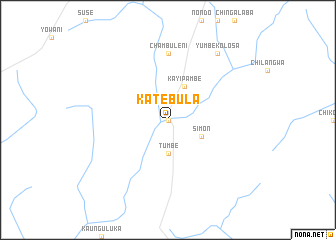
Nearby towns ::
Muzombe (0.0km north) //
Tumbe (3.7km south) //
Simon (4.1km south east) //
Kayipambe (4.1km north east) //
Chambuleni (7.4km north) //
Yumbe Kolosa (9.2km north east) //
[all distances 'as the bird flies' and approximate] 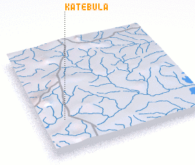 Places with similar names to Katebula, Zambia ::
// Catabla (PH)
// Kedai Bual (MY)
// Kodobol (RU)
// Kātbaola (BD)
// Godbila (BF)
// Koudouboul (TD)
// Kitobola (CD)
// Kutabuloh (ID)
// Kutabuluh (ID)
// Ktay-Bala (UZ)
Disclaimer :: Information on this page comes without warranty of any kind |
||
|
Where is Katebula? Elevation and coordinates ::
Latitude (lat): 9°40'0"S Longitude (lon): 31°10'0"E
Elevation (approx.): 1408m (map arrows pan, magnifying glasses zoom) |
||
|
Visiting Katebula? Hotel/Accommodation ::
Book a hotel in Katebula Travel Guide ::
Buy a travel guide for Zambia rental cars ::
car rental offers GPS waypoint ::
download a GPX waypoint (PoI) of Katebula for your GPS receiver
|
||