|
search place name
|
||
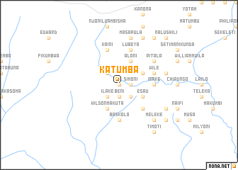
Katumba (Central, Zambia)Katumba is a town in the Central region of Zambia. An overview map of the region around Katumba is displayed below.
regional and 3d topo map of Katumba, Zambia ::
Katumba airports ::
The nearest airport is MFU - Mfuwe, located 145.1 km east of Katumba.
Other airports nearby include NLA - Ndola (210.8 km west), Nearby towns ::
Spaita (0.0km north) //
Simoni (1.8km east) //
Beni (1.9km south) //
Finisha Matesa (2.6km north west) //
Chitimpa (2.6km south east) //
Ilake (2.6km south west) //
Kalikania (4.1km north east) //
Aloni (4.1km north east) //
Esau (4.1km south east) //
Wilson Makuta (4.1km south west) //
Lusomena Mbabula (5.2km south east) //
Isake (5.4km east) //
Baskolo (5.6km south) //
Wile (5.7km east) //
Lubeya (5.8km north) //
Kaini (5.8km north) //
Pitala (6.6km north east) //
Masapula (7.6km north) //
Chibungo (7.5km east) //
Meleke (7.8km south east) //
Lembo (8.2km north east) //
Chachi Mpika (8.1km south east) //
Jeremea (9.2km north east) //
Ketutu Chisesa (9.2km north east) //
Timoti (9.2km south east) //
Katota (9.1km south east) //
Nalushili (10.3km north east) //
[all distances 'as the bird flies' and approximate] 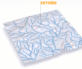 Places with similar names to Katumba, Zambia ::
Disclaimer :: Information on this page comes without warranty of any kind |
||
|
Where is Katumba? Elevation and coordinates ::
Latitude (lat): 13°11'0"S Longitude (lon): 30°36'0"E
Elevation (approx.): 1502m (map arrows pan, magnifying glasses zoom) |
||
|
Visiting Katumba? Hotel/Accommodation ::
Book a hotel in Katumba Travel Guide ::
Buy a travel guide for Zambia rental cars ::
car rental offers GPS waypoint ::
download a GPX waypoint (PoI) of Katumba for your GPS receiver
|
||