|
search place name
|
||
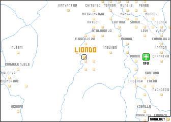
Liondo (Eastern, Zambia)Liondo is a town in the Eastern region of Zambia. An overview map of the region around Liondo is displayed below.
regional and 3d topo map of Liondo, Zambia ::
Liondo airports ::
The nearest airport is MFU - Mfuwe, located 13.0 km east of Liondo.
Other airports nearby include LLW - Lilongwe Kamuzu Intl (220.4 km east), Nearby towns ::
Mwando (0.0km north) //
Kaweche (0.0km north) //
Katwizi (1.8km east) //
Chota (1.9km south) //
Chundu (2.6km south east) //
Chune (2.6km north west) //
Isaac Njovu (3.7km north) //
Juma Mwanza (5.6km north) //
Kalomba (5.8km north) //
Masumba (5.7km east) //
Mtalimanja (6.6km north east) //
Chimwendo (7.6km north) //
Katuzi (7.6km north) //
Kapainzi (8.2km north east) //
Manase (9.1km north east) //
Chitindi (10.3km north east) //
[all distances 'as the bird flies' and approximate] 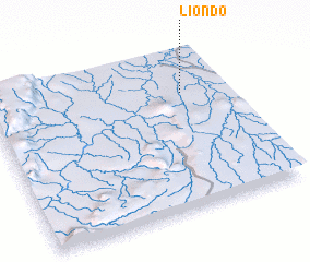 Places with similar names to Liondo, Zambia ::
Disclaimer :: Information on this page comes without warranty of any kind |
||
|
Where is Liondo? Elevation and coordinates ::
Latitude (lat): 13°16'0"S Longitude (lon): 31°49'0"E
Elevation (approx.): 600m (map arrows pan, magnifying glasses zoom) |
||
|
Visiting Liondo? Hotel/Accommodation ::
Book a hotel in Liondo Travel Guide ::
Buy a travel guide for Zambia rental cars ::
car rental offers GPS waypoint ::
download a GPX waypoint (PoI) of Liondo for your GPS receiver
|
||