|
search place name
|
||
Litebele (Western, Zambia)Litebele is a town in the Western region of Zambia. An overview map of the region around Litebele is displayed below.
regional and 3d topo map of Litebele, Zambia ::
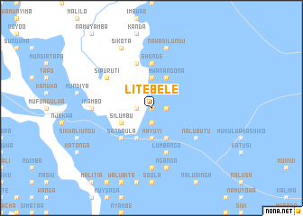
Nearby towns ::
Lipimili (0.0km north) //
Kawina (0.0km north) //
Nanikelako (1.9km south) //
Lipalile (1.8km west) //
Sandi (1.9km north) //
Mwanamwela (1.8km east) //
Inguwe (3.7km south) //
Mayuyi (3.7km south) //
Makono (3.7km north) //
Mulala (4.0km south west) //
Silumbu (4.0km south west) //
Nangulive (4.1km south west) //
Mufungulo (4.1km south east) //
Mwanangona (4.1km north east) //
Sandaula (5.2km south west) //
Lingomba (5.6km north) //
Shonge (5.6km north) //
Liyaneno (5.8km south) //
Lumbango (5.8km south) //
Pulu (5.8km north) //
Nalubutu (6.5km south east) //
Lealui (6.5km south east) //
Sipuruti (6.5km north west) //
Mukulwamwandi (7.4km south) //
Imambo (7.2km west) //
Nganga (7.6km south) //
Indilonga (7.6km south) //
Nawasilundu (7.6km north) //
Ibukwe (7.6km north) //
[all distances 'as the bird flies' and approximate] 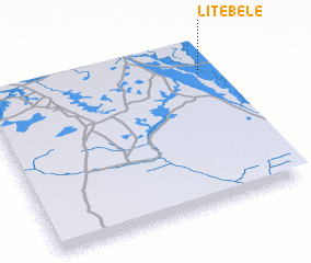 Places with similar names to Litebele, Zambia ::
Disclaimer :: Information on this page comes without warranty of any kind |
||
|
Where is Litebele? Elevation and coordinates ::
Latitude (lat): 15°10'0"S Longitude (lon): 22°57'0"E
Elevation (approx.): 1016m (map arrows pan, magnifying glasses zoom) |
||
|
Visiting Litebele? Hotel/Accommodation ::
Book a hotel in Litebele Travel Guide ::
Buy a travel guide for Zambia rental cars ::
car rental offers GPS waypoint ::
download a GPX waypoint (PoI) of Litebele for your GPS receiver
|
||