|
search place name
|
||
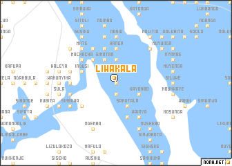
Liwakala (Western, Zambia)Liwakala is a town in the Western region of Zambia. An overview map of the region around Liwakala is displayed below.
regional and 3d topo map of Liwakala, Zambia ::
Nearby towns ::
Sitondo (0.0km north) //
Muyundanalwendo (0.0km north) //
Mbubu (0.0km north) //
Nambayo (0.0km north) //
Tungunga (1.9km south) //
Mumbali (1.9km south) //
Mwananyundo (1.9km south) //
Mwiya (1.9km south) //
Muzebe (1.9km north) //
Chilemu (1.9km north) //
Kweli (1.9km north) //
Kashimani (1.9km north) //
Mboo (3.7km north) //
Monga (3.7km north) //
Silishebo (3.7km north) //
Atanga (4.1km south east) //
Nanzila Kabuku (4.1km south east) //
Itwi (4.1km south east) //
Imuwana (4.1km south east) //
Samutala (4.1km south east) //
Amatende (4.1km south east) //
Kayombo (4.0km south east) //
Nambala (4.1km north west) //
Simataa (4.1km north west) //
Lingonsa (5.1km north west) //
Liaonga (5.1km north west) //
Wanga (5.6km north) //
Mushoke (5.8km north) //
Chiwamba (5.8km north) //
[all distances 'as the bird flies' and approximate] 
Disclaimer :: Information on this page comes without warranty of any kind |
||
|
Where is Liwakala? Elevation and coordinates ::
Latitude (lat): 15°19'0"S Longitude (lon): 22°50'0"E
Elevation (approx.): 1019m (map arrows pan, magnifying glasses zoom) |
||
|
Visiting Liwakala? Hotel/Accommodation ::
Book a hotel in Liwakala Travel Guide ::
Buy a travel guide for Zambia rental cars ::
car rental offers GPS waypoint ::
download a GPX waypoint (PoI) of Liwakala for your GPS receiver
|
||