|
search place name
|
||
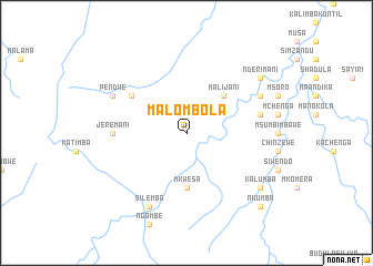
Malombola (Eastern, Zambia)Malombola is a town in the Eastern region of Zambia. An overview map of the region around Malombola is displayed below.
regional and 3d topo map of Malombola, Zambia ::
Malombola airports ::
The nearest airport is MFU - Mfuwe, located 43.4 km north of Malombola.
Other airports nearby include LLW - Lilongwe Kamuzu Intl (213.2 km east), Nearby towns ::
Malijani (5.2km north east) //
Mkwesa (5.6km south) //
Andrea (6.6km north west) //
Jeremani (7.2km west) //
Makoka (7.4km east) //
Makoleka (8.1km north east) //
Pendwe (8.1km north west) //
Silemba (8.2km south west) //
Kalumba (9.1km south east) //
Nderimani (9.1km north east) //
Nkumba (10.3km south east) //
[all distances 'as the bird flies' and approximate] 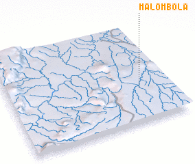 Places with similar names to Malombola, Zambia ::
// Mlamli (ZA)
// Mīlamīlē (ET)
// Melméle (TD)
// Malimbula (CD)
// Mbelembele (CD)
// Melomelo (CD)
// Miliambala (CD)
// Mulombela (CD)
// Mbouala Maouolo (CG)
// Milamila (CG)
Disclaimer :: Information on this page comes without warranty of any kind |
||
|
Where is Malombola? Elevation and coordinates ::
Latitude (lat): 13°38'0"S Longitude (lon): 31°49'0"E
Elevation (approx.): 735m (map arrows pan, magnifying glasses zoom) |
||
|
Visiting Malombola? Hotel/Accommodation ::
Book a hotel in Malombola Travel Guide ::
Buy a travel guide for Zambia rental cars ::
car rental offers GPS waypoint ::
download a GPX waypoint (PoI) of Malombola for your GPS receiver
|
||